|
search place name
|
||
Kampung Sungai Tembus (Pulau Pinang, Malaysia)Kampung Sungai Tembus is a town in the Pulau Pinang region of Malaysia. An overview map of the region around Kampung Sungai Tembus is displayed below.
regional and 3d topo map of Kampung Sungai Tembus, Malaysia ::

Kampung Sungai Tembus airports ::
The nearest airport is PEN - Penang Intl, located 25.7 km south west of Kampung Sungai Tembus.
Other airports nearby include AOR - Alor Setar Sultan Abdul Halim (75.1 km north), LGK - Pulau Langkawi Intl (114.8 km north west), IPH - Ipoh Sultan Azlan Shah (131.7 km south east), HDY - Songkhla Hat Yai Intl (157.3 km north), Nearby towns ::
Penaga (0.6km south) //
Kampong Bekah (0.6km north) //
Padang Benggali (1.2km south) //
Lahar Tabot (1.9km east) //
Kampong Permatang Rambai (1.9km east) //
Permatang Berah (1.9km east) //
Kampung Penaga (1.9km east) //
Permatang Kuala (1.9km east) //
Permatang Pa' Maras (1.9km east) //
Bagan Belat (2.2km south east) //
Kampong Padang Tembesu (3.1km north east) //
Bakar Kapor (3.1km north east) //
Lahar Endin (3.1km north east) //
Bagan Tambang (3.6km south east) //
Kampong Setol (3.6km south east) //
Telok Ayer Tawar (3.6km south east) //
Kampung Teluk Air Tawar (3.6km south east) //
Kampong Permatang Sintok (3.7km east) //
Kampong Permatang Pauh (3.7km east) //
Pokok Nangka (3.7km east) //
Permatang Binjai (3.9km east) //
Permatang Tok Gelam (3.9km east) //
Kampong Permatang Pak Elong (3.9km east) //
Selarong Gajah (3.9km east) //
Kampong Pasir Gebu (4.3km north) //
Paya Temusu (4.4km north east) //
Permatang Kuang Kechil (4.4km north east) //
Permatang Kuang Besar (4.4km north east) //
Permatang Kuang (4.4km north east) //
[all distances 'as the bird flies' and approximate] 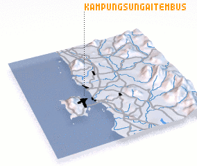 Places with similar names to Kampung Sungai Tembus, Malaysia ::
// Kampong Sungai Tembus (MY)
Disclaimer :: Information on this page comes without warranty of any kind |
||
|
Where is Kampung Sungai Tembus? Elevation and coordinates ::
Latitude (lat): 5°30'40"N Longitude (lon): 100°22'0"E
Elevation (approx.): -32768m (map arrows pan, magnifying glasses zoom) |
||
|
Visiting Kampung Sungai Tembus? Hotel/Accommodation ::
Book a hotel in Kampung Sungai Tembus Travel Guide ::
Buy a travel guide for Malaysia rental cars ::
car rental offers GPS waypoint ::
download a GPX waypoint (PoI) of Kampung Sungai Tembus for your GPS receiver
|
||