|
search place name
|
||
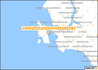
Kampung Sungai Pinang Besar (Perak, Malaysia)Kampung Sungai Pinang Besar is a town in the Perak region of Malaysia. An overview map of the region around Kampung Sungai Pinang Besar is displayed below.
regional and 3d topo map of Kampung Sungai Pinang Besar, Malaysia ::
Kampung Sungai Pinang Besar airports ::
The nearest airport is IPH - Ipoh Sultan Azlan Shah, located 68.6 km north east of Kampung Sungai Pinang Besar.
Other airports nearby include PEN - Penang Intl (124.2 km north), KUL - Kuala Lumpur Intl (205.3 km south east), AOR - Alor Setar Sultan Abdul Halim (219.1 km north), MES - Medan Polonia (224.5 km west), Nearby towns ::
Kampung Sungai Pinang Kecil (1.9km north) //
Kampong Balek Beting (1.9km north) //
Kampong Pasir Bogak (1.8km west) //
Pangkor (1.8km west) //
Kampong Batu Gajah (1.8km east) //
Kampong Telok Kechil (1.9km south) //
Kampung Teluk Gedong (1.9km south) //
Kampong Pasir Anging (2.6km north east) //
Kampong Telok Perepat (2.6km north east) //
Kampong Sungai Udang (3.7km west) //
Kampong Telok Chempadak (4.1km north west) //
Kampong Kuala Sempit (4.1km north east) //
Kampung Teluk Nipah (4.3km west) //
Pantai Puteri Dewi (5.2km north west) //
Kampong Tanjong Batu (5.2km north east) //
Kampong Selangor (5.2km north east) //
Kampong Tebing Rabak (5.5km east) //
Lumut (5.8km east) //
Kampong Telok Kupia (5.9km north) //
Kampung Damar Laut (6.7km north east) //
Kampong Sungai Sempit (6.7km north east) //
Kampong Telok Rabiah (6.7km south east) //
Kampong Telok Batu (6.7km south east) //
Kampong Pundut (7.6km east) //
Kampong Pak Melan (8.3km north east) //
Kampong Permatang (8.3km south east) //
Kampung Permatang (8.3km south east) //
Kampong Batu Tiga (9.3km north east) //
Kampung Padang (9.3km south east) //
[all distances 'as the bird flies' and approximate]  Places with similar names to Kampung Sungai Pinang Besar, Malaysia ::
// Kampong Sungai Pening (MY)
// Kampong Sungai Pinang (MY)
// Kampong Sungai Pinang (MY)
// Kampong Sungai Pinang (MY)
// Kampong Sungai Pinang (MY)
// Kampong Sungai Pinang (MY)
// Kampong Sungai Pinang (MY)
// Kampong Sungai Pinang (MY)
// Kampong Sungai Pinang (MY)
// Kampong Sungai Pinang (MY)
Disclaimer :: Information on this page comes without warranty of any kind |
||
|
Where is Kampung Sungai Pinang Besar? Elevation and coordinates ::
Latitude (lat): 4°13'0"N Longitude (lon): 100°35'0"E
Elevation (approx.): -32768m (map arrows pan, magnifying glasses zoom) |
||
|
Visiting Kampung Sungai Pinang Besar? Hotel/Accommodation ::
Book a hotel in Kampung Sungai Pinang Besar Travel Guide ::
Buy a travel guide for Malaysia rental cars ::
car rental offers GPS waypoint ::
download a GPX waypoint (PoI) of Kampung Sungai Pinang Besar for your GPS receiver
|
||