|
search place name
|
||
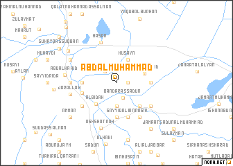
‘Abd al Muḩammad (Dhī Qār, Iraq)‘Abd al Muḩammad is a town in the Dhī Qār region of Iraq. An overview map of the region around ‘Abd al Muḩammad is displayed below.
regional and 3d topo map of ‘Abd al Muḩammad, Iraq ::
‘Abd al Muḩammad airports ::
The nearest airport is BSR - Basrah Intl, located 173.8 km south east of ‘Abd al Muḩammad.
Nearby towns ::
Ḩusayn al Khiḑr (1.6km east) //
Sa‘īd al ‘Abīd (2.4km north west) //
Bandar as Sa‘dūn (2.6km south) //
Sayyid al Jalīl (3.7km south) //
Ḩusayn (4.0km north east) //
Khaʼūn al ‘Abīd (4.1km east) //
Al Bid‘ah (4.5km south west) //
Sayyid Shanāwah (4.9km south east) //
Māshūl (4.7km east) //
Farḩān ar Rodham (5.6km south) //
Ālbū Hilālah (4.7km west) //
Mūsá al Majīd (5.0km west) //
Sayyid ‘Alī an Nāşir (5.8km south) //
Muhai al Khāfūr (6.4km south east) //
Jamā‘at Hashīsh as Suwaylim (6.0km south east) //
Sayyid Ghannām (6.0km south west) //
Ḩasan (6.9km north) //
Mashkūr (6.3km west) //
Jār Allāh (6.6km west) //
Ash Shaţrah (7.6km south) //
Hawāwīyah (7.3km north west) //
‘Abd al Wāḩid (7.3km west) //
Jamā‘at Hilāl (8.8km south east) //
‘Ammār (8.4km south west) //
An Naşr (8.4km north west) //
[all distances 'as the bird flies' and approximate]  Places with similar names to ‘Abd al Muḩammad, Iraq ::
Disclaimer :: Information on this page comes without warranty of any kind |
||
|
Where is ‘Abd al Muḩammad? Elevation and coordinates ::
Latitude (lat): 31°29'0"N Longitude (lon): 46°12'0"E
Elevation (approx.): 8m (map arrows pan, magnifying glasses zoom) |
||
|
Visiting ‘Abd al Muḩammad? Hotel/Accommodation ::
Book a hotel in ‘Abd al Muḩammad Travel Guide ::
Buy a travel guide for Iraq rental cars ::
car rental offers GPS waypoint ::
download a GPX waypoint (PoI) of ‘Abd al Muḩammad for your GPS receiver
|
||