|
search place name
|
||
Abū Şayyāḩ (Bābil, Iraq)Abū Şayyāḩ is a town in the Bābil region of Iraq. An overview map of the region around Abū Şayyāḩ is displayed below.
regional and 3d topo map of Abū Şayyāḩ, Iraq ::

Nearby towns ::
Ash Shaykh ‘Alī (2.4km south east) //
‘Arab ‘Abd Allāh Khaţţāb (4.0km south west) //
‘Abd Allāh Aḩmad (4.6km west) //
Shahāb ar Rajah (5.1km south west) //
Hādī Jāyid (5.3km south west) //
Jurf aş Şakhr (5.5km south west) //
Hādī Muḩammad (5.4km west) //
Şunaydīq (6.5km south west) //
Khuḑayr ‘Abbās (6.1km west) //
Jāsim al Ḩammādī (7.4km south) //
Qaryat al Ḩuwayjah (6.5km north west) //
Qaryat Ḩandīj (6.9km south west) //
Arāḑī Shubbāk al Khiḑr (6.5km west) //
Abū Shamsīyah (6.5km west) //
‘Arab ‘Abd Khaḑīr ad Dawsh (6.6km west) //
Muḩammad Salmān Ḩasan (6.9km west) //
Jāsim Muḩammad (7.0km north west) //
Qaryat ar Rū‘īyah (7.3km south west) //
‘Abbās Fayḩān (7.3km west) //
Qaryat as Sa‘īdāt (8.3km south west) //
Ḩamzah (8.7km south) //
‘Umrān Ḩusayn (7.7km north east) //
Qaryat Umm al Ḩayāyah (9.2km north west) //
‘Arab ‘Alī az̧ Z̧āhir (11.0km north west) //
[all distances 'as the bird flies' and approximate] 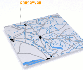 Places with similar names to Abū Şayyāḩ, Iraq ::
Disclaimer :: Information on this page comes without warranty of any kind |
||
|
Where is Abū Şayyāḩ? Elevation and coordinates ::
Latitude (lat): 32°54'0"N Longitude (lon): 44°16'0"E
Elevation (approx.): 32m (map arrows pan, magnifying glasses zoom) |
||
|
Visiting Abū Şayyāḩ? Hotel/Accommodation ::
Book a hotel in Abū Şayyāḩ Travel Guide ::
Buy a travel guide for Iraq rental cars ::
car rental offers GPS waypoint ::
download a GPX waypoint (PoI) of Abū Şayyāḩ for your GPS receiver
|
||