|
search place name
|
||
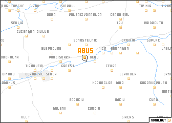
Abuş (Covurlui, Romania)Abuş is a town in the Covurlui region of Romania. An overview map of the region around Abuş is displayed below.
regional and 3d topo map of Abuş, Romania ::
Abuş airports ::
The nearest airport is TGM - Tirgu Mures Vidrasau, located 13.3 km north of Abuş.
Other airports nearby include SBZ - Sibiu (66.7 km south), CLJ - Cluj-napoca Cluj Napoca (72.1 km north west), BAY - Baia Mare Tautii Magheraus (161.2 km north west), SUJ - Satu Mare (188.7 km north west), Nearby towns ::
Deaj (1.3km east) //
Şomoştelnic (3.7km north) //
Găneşti (3.2km south west) //
Mica (3.2km north east) //
După Deal (3.2km north east) //
Lăscud (4.5km north west) //
Păucişoara (3.8km west) //
Ceuaş (4.3km south east) //
Căpîlna de Sus (4.3km north east) //
Hărănglab (6.1km south east) //
Subpădure (5.4km west) //
Cuştelnic (5.4km west) //
Bernadea (5.4km east) //
Seuca (6.3km south west) //
Daia (7.6km south east) //
Tău (9.0km north east) //
Cerghid (9.0km north east) //
Grui (9.0km north east) //
[all distances 'as the bird flies' and approximate] 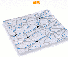 Places with similar names to Abuş, Romania ::
Disclaimer :: Information on this page comes without warranty of any kind |
||
|
Where is Abuş? Elevation and coordinates ::
Latitude (lat): 46°21'0"N Longitude (lon): 24°23'0"E
Elevation (approx.): 289m (map arrows pan, magnifying glasses zoom) |
||
|
Visiting Abuş? Hotel/Accommodation ::
Book a hotel in Abuş Travel Guide ::
Buy a travel guide for Romania rental cars ::
car rental offers GPS waypoint ::
download a GPX waypoint (PoI) of Abuş for your GPS receiver
|
||