|
search place name
|
||
‘Amm al Ḩusayn (Al Muthanná, Iraq)‘Amm al Ḩusayn is a town in the Al Muthanná region of Iraq. An overview map of the region around ‘Amm al Ḩusayn is displayed below.
regional and 3d topo map of ‘Amm al Ḩusayn, Iraq ::

‘Amm al Ḩusayn airports ::
The nearest airport is BSR - Basrah Intl, located 158.9 km south east of ‘Amm al Ḩusayn.
Nearby towns ::
Kāz̧im al Fahd (0.8km east) //
Ziyādāt (2.2km south west) //
‘Ajīl aţ Ţarbūsh (2.9km south) //
Ziyādāt (3.7km south west) //
Ţarbūsh (5.1km north west) //
Umm as Sadd (5.5km south) //
‘Abd Allāh (5.2km north east) //
Farhūd al Ḩamad (6.1km north) //
Ḩusayn (6.1km south west) //
Marhash al Khuḑayyir (6.7km north west) //
Ālbū Ḩawālah (7.3km south) //
Ḩasan ash Shabbāḩ (6.7km south west) //
Jabr (6.5km east) //
‘Abd al Ḩusayn (7.9km north) //
Muḩammad al ‘Ulayb (7.8km south east) //
Mūsá (7.8km north west) //
Mūsá al Maţar (8.7km north) //
Al Gharrāf (8.9km north east) //
[all distances 'as the bird flies' and approximate] 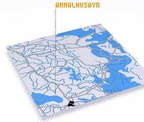 Places with similar names to ‘Amm al Ḩusayn, Iraq ::
Disclaimer :: Information on this page comes without warranty of any kind |
||
|
Where is ‘Amm al Ḩusayn? Elevation and coordinates ::
Latitude (lat): 31°13'50"N Longitude (lon): 46°12'0"E
Elevation (approx.): 9m (map arrows pan, magnifying glasses zoom) |
||
|
Visiting ‘Amm al Ḩusayn? Hotel/Accommodation ::
Book a hotel in ‘Amm al Ḩusayn Travel Guide ::
Buy a travel guide for Iraq rental cars ::
car rental offers GPS waypoint ::
download a GPX waypoint (PoI) of ‘Amm al Ḩusayn for your GPS receiver
|
||