|
search place name
|
||
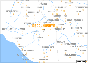
‘Abd al Ḩusayn (Dhī Qār, Iraq)‘Abd al Ḩusayn is a town in the Dhī Qār region of Iraq. An overview map of the region around ‘Abd al Ḩusayn is displayed below.
regional and 3d topo map of ‘Abd al Ḩusayn, Iraq ::
‘Abd al Ḩusayn airports ::
The nearest airport is BSR - Basrah Intl, located 164.0 km south east of ‘Abd al Ḩusayn.
Nearby towns ::
Farhūd al Ḩamad (2.3km south east) //
Marhash al Khuḑayyir (2.4km south west) //
Şugbān al ‘Alī (2.7km north) //
Mūsá al Maţar (2.5km east) //
Mūsá (2.9km south west) //
Ţarbūsh (4.0km south west) //
Sayyid Jabbār (3.7km north west) //
Muḩsin al Karīm (4.9km north east) //
Nāʼif as Sarāb (5.1km east) //
Āl Şayyāḩ (6.4km north west) //
‘Abd Khalaf (6.0km north west) //
Al Gharrāf (6.0km east) //
Malājī (6.6km east) //
Khūbchīra (7.3km north east) //
‘Amm al Ḩusayn (7.9km south) //
Albū Khulayf (7.9km north west) //
Ibn Ḩusayn (8.1km north east) //
Kāz̧im al Fahd (8.2km south) //
Jahal (8.4km north west) //
Abū Shifyat al Mar‘at (8.4km north west) //
Ḩusayn al Ju‘ayn (8.8km north east) //
‘Abd Allāh (8.4km south east) //
Thāmir al Qaţranī (9.7km north west) //
Faraj az Zajjī (11.4km north east) //
[all distances 'as the bird flies' and approximate]  Places with similar names to ‘Abd al Ḩusayn, Iraq ::
// Abdalhasan (TR)
// ‘Abd al Ḩasan (IQ)
// ‘Abd al Ḩassūn (IQ)
// ‘Abd al Ḩusayn (IQ)
// ‘Abd al Ḩusayn (IQ)
// ‘Abd al Ḩusayn (IQ)
// ‘Abd al Ḩusayn (IQ)
// ‘Abd al Ḩusayn (IQ)
// ‘Abd ol Ḩoseyn (IR)
Disclaimer :: Information on this page comes without warranty of any kind |
||
|
Where is ‘Abd al Ḩusayn? Elevation and coordinates ::
Latitude (lat): 31°18'0"N Longitude (lon): 46°11'0"E
Elevation (approx.): 7m (map arrows pan, magnifying glasses zoom) |
||
|
Visiting ‘Abd al Ḩusayn? Hotel/Accommodation ::
Book a hotel in ‘Abd al Ḩusayn Travel Guide ::
Buy a travel guide for Iraq rental cars ::
car rental offers GPS waypoint ::
download a GPX waypoint (PoI) of ‘Abd al Ḩusayn for your GPS receiver
|
||