|
search place name
|
||
Lālā Ḩumrān (As Sulaymānīyah, Iraq)Lālā Ḩumrān is a town in the As Sulaymānīyah region of Iraq. An overview map of the region around Lālā Ḩumrān is displayed below.
regional and 3d topo map of Lālā Ḩumrān, Iraq ::

Lālā Ḩumrān airports ::
The nearest airport is SDG - Sanandaj, located 120.4 km south east of Lālā Ḩumrān.
Other airports nearby include KSH - Bakhtaran Shahid Ashrafi Esfahani (198.1 km south east), Nearby towns ::
Bāhī (2.0km south west) //
Gola (2.4km north west) //
Kokh (2.7km west) //
Mosherau (3.5km north) //
Shāhwāli (3.1km north west) //
Pāshābard (3.7km north) //
Zangedar (3.8km south) //
Sayrānah (3.4km east) //
Spīdārah (4.8km south west) //
Kānī Mīrān (5.6km south) //
Siyāh Gūz (5.8km north west) //
Binawian (6.7km south) //
Mīr ‘Abdal (6.0km north east) //
Bistan (5.9km south east) //
Chamak (6.3km south west) //
Sūrāb (7.2km north) //
Kunāmār (6.4km east) //
Kānī Seyf (7.7km north) //
Rangina (7.5km south west) //
Qūsah Madīnah (6.8km west) //
Kāragal (7.4km north east) //
Shaykh al Mārayn (8.0km south west) //
‘Ulyāwah (8.3km south east) //
Sulaimānadol (9.2km south) //
Chūpārv (8.7km north west) //
Kūkh Halāleh Ebrāhīm (9.6km north east) //
Hameh Khānemīyeh (9.6km north east) //
‘Umar Sina (10.8km south east) //
[all distances 'as the bird flies' and approximate] 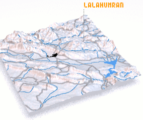 Places with similar names to Lālā Ḩumrān, Iraq :: Disclaimer :: Information on this page comes without warranty of any kind |
||
|
Where is Lālā Ḩumrān? Elevation and coordinates ::
Latitude (lat): 35°46'6"N Longitude (lon): 45°50'46"E
Elevation (approx.): 1210m (map arrows pan, magnifying glasses zoom) |
||
|
Visiting Lālā Ḩumrān? Hotel/Accommodation ::
Book a hotel in Lālā Ḩumrān Travel Guide ::
Buy a travel guide for Iraq rental cars ::
car rental offers GPS waypoint ::
download a GPX waypoint (PoI) of Lālā Ḩumrān for your GPS receiver
|
||