|
search place name
|
||
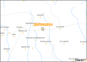
Qarah Dāgh (Nīnawá, Iraq)Qarah Dāgh is a town in the Nīnawá region of Iraq. An overview map of the region around Qarah Dāgh is displayed below.
regional and 3d topo map of Qarah Dāgh, Iraq ::
Qarah Dāgh airports ::
The nearest airport is BAL - Batman, located 194.1 km north of Qarah Dāgh.
Other airports nearby include DEZ - Deire Zor Deir Zzor (196.2 km south west), DIY - Diyabakir Diyarbakir (234.3 km north west), Nearby towns ::
Tappah Ishkāfīyah (4.3km north west) //
Shārū al Gharbī Bashūk (4.8km south west) //
‘Ayn al Ghazāl (5.5km south) //
Mīr Khān (6.1km north) //
Dilū Khān (5.9km east) //
Nārinjūk (8.2km south west) //
Kun Ruvī (10.0km south west) //
Qābūsīyah (10.1km south west) //
[all distances 'as the bird flies' and approximate] 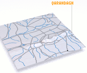 Places with similar names to Qarah Dāgh, Iraq ::
Disclaimer :: Information on this page comes without warranty of any kind |
||
|
Where is Qarah Dāgh? Elevation and coordinates ::
Latitude (lat): 36°18'37"N Longitude (lon): 41°56'39"E
Elevation (approx.): 464m (map arrows pan, magnifying glasses zoom) |
||
|
Visiting Qarah Dāgh? Hotel/Accommodation ::
Book a hotel in Qarah Dāgh Travel Guide ::
Buy a travel guide for Iraq rental cars ::
car rental offers GPS waypoint ::
download a GPX waypoint (PoI) of Qarah Dāgh for your GPS receiver
|
||