|
search place name
|
||
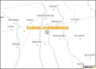
Shārū al Gharbī Bashūk (Nīnawá, Iraq)Shārū al Gharbī Bashūk is a town in the Nīnawá region of Iraq. An overview map of the region around Shārū al Gharbī Bashūk is displayed below.
regional and 3d topo map of Shārū al Gharbī Bashūk, Iraq ::
Shārū al Gharbī Bashūk airports ::
The nearest airport is DEZ - Deire Zor Deir Zzor, located 191.6 km south west of Shārū al Gharbī Bashūk.
Other airports nearby include BAL - Batman (196.6 km north), DIY - Diyabakir Diyarbakir (235.3 km north west), Nearby towns ::
Nārinjūk (3.6km south) //
‘Ayn al Ghazāl (4.0km south east) //
Qarah Dāgh (4.8km north east) //
Kun Ruvī (5.3km south west) //
Qābūsīyah (5.3km south west) //
Şabāḩīyah (5.3km north west) //
Tappah Ishkāfīyah (6.2km north) //
Sinjār (7.2km north west) //
[all distances 'as the bird flies' and approximate]  Places with similar names to Shārū al Gharbī Bashūk, Iraq :: Disclaimer :: Information on this page comes without warranty of any kind |
||
|
Where is Shārū al Gharbī Bashūk? Elevation and coordinates ::
Latitude (lat): 36°16'34"N Longitude (lon): 41°54'44"E
Elevation (approx.): 426m (map arrows pan, magnifying glasses zoom) |
||
|
Visiting Shārū al Gharbī Bashūk? Hotel/Accommodation ::
Book a hotel in Shārū al Gharbī Bashūk Travel Guide ::
Buy a travel guide for Iraq rental cars ::
car rental offers GPS waypoint ::
download a GPX waypoint (PoI) of Shārū al Gharbī Bashūk for your GPS receiver
|
||