|
search place name
|
||
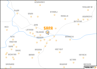
Sara (Arbīl, Iraq)Sara is a town in the Arbīl region of Iraq. An overview map of the region around Sara is displayed below.
regional and 3d topo map of Sara, Iraq ::
Sara airports ::
The nearest airport is VAN - Van, located 160.9 km north west of Sara.
Nearby towns ::
Zīlān (2.1km south) //
Pir-ā Chāmā (1.8km south east) //
Chāmār (2.4km south west) //
Tōlākha (2.5km west) //
Akīka (3.4km south) //
Ardawēl (3.2km north east) //
Gilāna (3.3km south east) //
Bārāna (3.4km south west) //
Māwata (4.6km south) //
Dirē (4.6km north west) //
Zahna (4.3km west) //
Birna (4.8km south west) //
Khwarna (4.9km west) //
Lāta ‘Īsā (5.7km west) //
Argōsh (7.6km south west) //
Ayranlı (7.9km north) //
Koçyiğit (7.6km south east) //
Nāwchāli (7.7km north west) //
Ormancık (6.9km east) //
Meşelik (7.9km north east) //
Snūni (8.8km north west) //
[all distances 'as the bird flies' and approximate]  Places with similar names to Sara, Iraq ::
Disclaimer :: Information on this page comes without warranty of any kind |
||
|
Where is Sara? Elevation and coordinates ::
Latitude (lat): 37°11'51"N Longitude (lon): 44°12'46"E
Elevation (approx.): 1025m (map arrows pan, magnifying glasses zoom) |
||
|
Visiting Sara? Hotel/Accommodation ::
Book a hotel in Sara Travel Guide ::
Buy a travel guide for Iraq rental cars ::
car rental offers GPS waypoint ::
download a GPX waypoint (PoI) of Sara for your GPS receiver
|
||