|
search place name
|
||
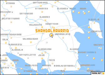
Shahd al Mawārid (Dhī Qār, Iraq)Shahd al Mawārid is a town in the Dhī Qār region of Iraq. An overview map of the region around Shahd al Mawārid is displayed below.
regional and 3d topo map of Shahd al Mawārid, Iraq ::
Shahd al Mawārid airports ::
The nearest airport is BSR - Basrah Intl, located 130.5 km south east of Shahd al Mawārid.
Other airports nearby include ABD - Abadan (187.9 km south east), KWI - Kuwait Intl (254.6 km south east), Nearby towns ::
Kharāʼib Muţashshar (2.5km south west) //
Qaryat al Farhah (3.5km north) //
Kāʼid aţ Ţāhir (3.7km north) //
Dār Kāʼid al ‘Atīq (3.2km east) //
Sayyid Dakhīl (3.5km north west) //
Mahdī Āl Şāliḩ al Bāghir (4.9km north west) //
Al Ḩaşāşirah (5.8km south west) //
Al Ḩasan (6.4km south west) //
Ḩājj Ḩusayn (6.0km north west) //
Al Ḩamrān (6.6km north) //
Şāliḩ ad Dāghir (6.8km west) //
Julūb (8.1km south west) //
Al Khaḑr (8.7km south east) //
Sayyid Fulayyiḩ (10.4km south west) //
[all distances 'as the bird flies' and approximate] 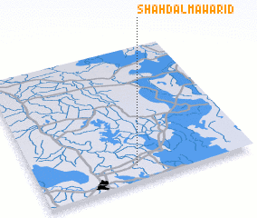 Places with similar names to Shahd al Mawārid, Iraq :: Disclaimer :: Information on this page comes without warranty of any kind |
||
|
Where is Shahd al Mawārid? Elevation and coordinates ::
Latitude (lat): 31°7'0"N Longitude (lon): 46°28'0"E
Elevation (approx.): 6m (map arrows pan, magnifying glasses zoom) |
||
|
Visiting Shahd al Mawārid? Hotel/Accommodation ::
Book a hotel in Shahd al Mawārid Travel Guide ::
Buy a travel guide for Iraq rental cars ::
car rental offers GPS waypoint ::
download a GPX waypoint (PoI) of Shahd al Mawārid for your GPS receiver
|
||