|
search place name
|
||
Shōrah Zarkah (Arbīl, Iraq)Shōrah Zarkah is a town in the Arbīl region of Iraq. An overview map of the region around Shōrah Zarkah is displayed below.
regional and 3d topo map of Shōrah Zarkah, Iraq ::
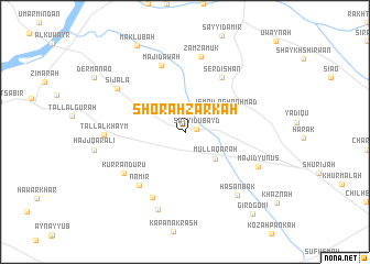
Nearby towns ::
Sayyid ‘Ubayd (1.0km east) //
Ismā‘īl Aghā ‘Abd Allāh (2.3km north) //
Mullā Qarah (3.8km south east) //
Ismā‘īl Āghā Aḩmad (4.0km north east) //
Serdishān (6.3km north east) //
Nāmir (6.6km south west) //
Mājidāwah (7.1km north) //
Bīrbirāzah (7.1km south) //
Kurranduru (6.5km south west) //
Zamzamūk (7.7km north) //
Tall al Khaym (6.6km west) //
Sijāla (7.1km north west) //
Mājid Yūnus (7.0km south east) //
Ḩasan Bak (7.7km south east) //
Shaykh ‘Alāf (8.2km south) //
Maklūbah (9.6km north west) //
Gird Gōmī (10.0km south east) //
[all distances 'as the bird flies' and approximate] 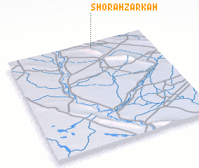 Places with similar names to Shōrah Zarkah, Iraq ::
Disclaimer :: Information on this page comes without warranty of any kind |
||
|
Where is Shōrah Zarkah? Elevation and coordinates ::
Latitude (lat): 35°58'0"N Longitude (lon): 43°37'0"E
Elevation (approx.): 265m (map arrows pan, magnifying glasses zoom) |
||
|
Visiting Shōrah Zarkah? Hotel/Accommodation ::
Book a hotel in Shōrah Zarkah Travel Guide ::
Buy a travel guide for Iraq rental cars ::
car rental offers GPS waypoint ::
download a GPX waypoint (PoI) of Shōrah Zarkah for your GPS receiver
|
||