|
search place name
|
||
‘Abbāsābād (Tehrān, Iran)‘Abbāsābād is a town in the Tehrān region of Iran. An overview map of the region around ‘Abbāsābād is displayed below.
regional and 3d topo map of ‘Abbāsābād, Iran ::

‘Abbāsābād airports ::
The nearest airport is THR - Teheran Mehrabad Intl, located 67.4 km north west of ‘Abbāsābād.
Other airports nearby include RZR - Ramsar (214.3 km north west), Nearby towns ::
Mehdīābād (1.8km south east) //
Karīmābād (3.0km north) //
Jahānābād (3.2km east) //
Moḩsenābād (5.5km north) //
Qal‘eh-ye Sālārīyeh (4.8km south west) //
Zolfābād (5.8km north) //
Ţoghān (5.9km north east) //
Najafābād (5.9km north east) //
Emāmzādeh Hādī (6.7km north east) //
Ḩoseynābād-e Qashqā'ī (7.8km north) //
Ḩeşār-e Qāẕī (7.3km north east) //
Ḩājjīābād-e Sālār (8.2km north west) //
Z̧ahīrābād (8.6km north) //
Kahrīzak-e Būr Būr (8.8km north) //
Javādābād (9.1km north east) //
Ebrāhīmābād (9.4km north east) //
Fakhrābād (9.9km north west) //
[all distances 'as the bird flies' and approximate] 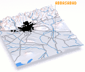 Places with similar names to ‘Abbāsābād, Iran ::
// 'Abāsābād (IR)
// Abbāsābād (IR)
// Abbāsābād (IR)
// Abbāsābād (IR)
// Abū Zabad (SD)
// Abbāsābād (PK)
// ‘Abbāsābād (IR)
// ‘Abas̄ābād (IR)
// ‘Abāsābād (IR)
// ‘Abbasābād (IR)
Disclaimer :: Information on this page comes without warranty of any kind |
||
|
Where is ‘Abbāsābād? Elevation and coordinates ::
Latitude (lat): 35°8'19"N Longitude (lon): 51°37'42"E
Elevation (approx.): 825m (map arrows pan, magnifying glasses zoom) |
||
|
Visiting ‘Abbāsābād? Hotel/Accommodation ::
Book a hotel in ‘Abbāsābād Travel Guide ::
Buy a travel guide for Iran rental cars ::
car rental offers GPS waypoint ::
download a GPX waypoint (PoI) of ‘Abbāsābād for your GPS receiver
|
||