|
search place name
|
||
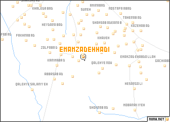
Emāmzādeh Hādī (Tehrān, Iran)Emāmzādeh Hādī is a town in the Tehrān region of Iran. An overview map of the region around Emāmzādeh Hādī is displayed below.
regional and 3d topo map of Emāmzādeh Hādī, Iran ::
Emāmzādeh Hādī airports ::
The nearest airport is THR - Teheran Mehrabad Intl, located 66.6 km north west of Emāmzādeh Hādī.
Other airports nearby include RZR - Ramsar (213.0 km north west), Nearby towns ::
Najafābād (1.1km west) //
Ḩeşār-e Qāẕī (1.5km north) //
Ţoghān (2.5km north west) //
Ebrāhīmābād (3.1km north) //
Asadābād (3.5km north east) //
Tappeh Marjān (3.7km south east) //
Qal‘eh-ye Now (3.6km south east) //
Javādābād (4.3km north) //
Jahānābād (4.1km south west) //
Ḩeşār-e Ḩasan Beyk (4.3km north east) //
Moḩsenābād (4.5km west) //
Aḩmadābād (5.8km north) //
Khāveh (5.3km north east) //
Karīmābād (5.1km west) //
Ḩeşār-e Bālā (6.1km north) //
Tajareh (6.5km north) //
Ḩoseynābād-e Qashqā'ī (5.9km north west) //
Owlīā' (5.6km east) //
Dowlatābād (5.6km east) //
Mehdīābād (6.4km south west) //
Emāmzādeh Shaşt (7.0km north) //
Ja‘farābād-e Jangal (6.8km north west) //
‘Abbāsābād (6.7km south west) //
Ḩeşār-e Kūchak (6.8km north east) //
Zolfābād (6.6km west) //
Zavāreh Var (8.1km north) //
Z̧ahīrābād (7.3km north west) //
Rostamābād (8.4km north) //
‘Alīābād-e Moḩīţ (7.9km north east) //
[all distances 'as the bird flies' and approximate]  Places with similar names to Emāmzādeh Hādī, Iran :: Disclaimer :: Information on this page comes without warranty of any kind |
||
|
Where is Emāmzādeh Hādī? Elevation and coordinates ::
Latitude (lat): 35°10'26"N Longitude (lon): 51°41'19"E
Elevation (approx.): 829m (map arrows pan, magnifying glasses zoom) |
||
|
Visiting Emāmzādeh Hādī? Hotel/Accommodation ::
Book a hotel in Emāmzādeh Hādī Travel Guide ::
Buy a travel guide for Iran rental cars ::
car rental offers GPS waypoint ::
download a GPX waypoint (PoI) of Emāmzādeh Hādī for your GPS receiver
|
||