|
search place name
|
||
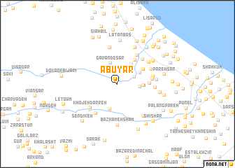
Ābūyār (Gīlān, Iran)Ābūyār is a town in the Gīlān region of Iran. An overview map of the region around Ābūyār is displayed below.
regional and 3d topo map of Ābūyār, Iran ::
Ābūyār airports ::
The nearest airport is RAS - Rasht, located 59.8 km south east of Ābūyār.
Other airports nearby include RZR - Ramsar (165.7 km south east), Nearby towns ::
Charān (2.3km north east) //
Naz̧ar Maḩalleh-ye Charān (2.7km north) //
Shar Shar Maḩalleh (2.4km north east) //
Gavānd-e Sar (3.4km north) //
Posht Ravān (2.9km east) //
Kūhestān-e Bālā (3.5km north east) //
Māzū Poshteh (3.4km north east) //
Sharābandī (3.3km east) //
Gapal Bār (4.1km south) //
Janbeh Sarā (3.4km east) //
Shīr Amīr Maḩalleh (4.4km north east) //
Kalāntar Maḩalleh (4.0km north east) //
Sīāh Maḩalleh (4.1km east) //
Dīnāchāl (5.0km north east) //
Kolāb-e Bālā (5.3km north east) //
Sīāh Makān (4.5km east) //
Sangdeh-e Bālā (4.6km east) //
Khojeh Darreh (5.2km south west) //
Dokān-e Solţān (5.4km south west) //
Kūhestān-e Pā'īn (4.9km north east) //
Dīgeh Sarā (5.9km north) //
Sangdeh-e Pā'īn (5.2km north east) //
Mollā Maḩalleh (4.8km east) //
Şeyqal Sarā (5.0km east) //
Khālīār (6.2km north) //
Shahrak-e Valī-ye ‘Aşr (6.0km south east) //
Bāzkamehsham (6.5km south) //
Pīsh Maḩalleh (5.8km north east) //
Latanbas (7.0km north) //
[all distances 'as the bird flies' and approximate] 
Disclaimer :: Information on this page comes without warranty of any kind |
||
|
Where is Ābūyār? Elevation and coordinates ::
Latitude (lat): 37°34'21"N Longitude (lon): 49°0'20"E
Elevation (approx.): 442m (map arrows pan, magnifying glasses zoom) |
||
|
Visiting Ābūyār? Hotel/Accommodation ::
Book a hotel in Ābūyār Travel Guide ::
Buy a travel guide for Iran rental cars ::
car rental offers GPS waypoint ::
download a GPX waypoint (PoI) of Ābūyār for your GPS receiver
|
||