|
search place name
|
||
Khojeh Darreh (Gīlān, Iran)Khojeh Darreh is a town in the Gīlān region of Iran. An overview map of the region around Khojeh Darreh is displayed below.
regional and 3d topo map of Khojeh Darreh, Iran ::

Khojeh Darreh airports ::
The nearest airport is RAS - Rasht, located 61.3 km south east of Khojeh Darreh.
Other airports nearby include RZR - Ramsar (167.3 km south east), Nearby towns ::
Dokān-e Solţān (1.1km south east) //
Sendīkeh (2.3km south west) //
Gapal Bār (2.5km east) //
Letowm (3.4km west) //
Dokān-e Shīr ‘Alī (3.5km west) //
Bāzkamehsham (4.4km south east) //
Leţe'īn (5.6km south) //
Ābūyār (5.2km north east) //
Sarak (5.8km south) //
Bolakhtār (6.3km south) //
Now Deh (5.4km west) //
Dokān-e Bījārī (6.2km north west) //
Shīrvā (6.9km south) //
Vazmī (6.8km south west) //
Tameshtān (5.9km west) //
Gavānd-e Sar (7.6km north) //
Balangāh (7.5km south west) //
Naz̧ar Maḩalleh-ye Charān (7.4km north east) //
Charān (7.4km north east) //
Dowrān (7.0km south east) //
Shahrak-e Valī-ye ‘Aşr (6.8km east) //
Shar Shar Maḩalleh (7.4km north east) //
Posht Ravān (7.2km north east) //
Sīāhbīl (7.9km south west) //
Estakhr Kenār (7.0km west) //
Kohneh Keh (7.0km west) //
Vīānsar (7.2km west) //
Sharābandī (7.6km north east) //
Dakān Veshāleh (8.0km north west) //
[all distances 'as the bird flies' and approximate] 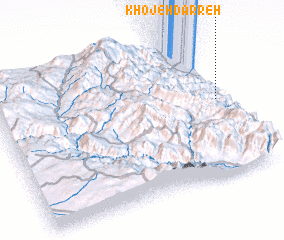 Places with similar names to Khojeh Darreh, Iran :: Disclaimer :: Information on this page comes without warranty of any kind |
||
|
Where is Khojeh Darreh? Elevation and coordinates ::
Latitude (lat): 37°32'17"N Longitude (lon): 48°57'59"E
Elevation (approx.): 418m (map arrows pan, magnifying glasses zoom) |
||
|
Visiting Khojeh Darreh? Hotel/Accommodation ::
Book a hotel in Khojeh Darreh Travel Guide ::
Buy a travel guide for Iran rental cars ::
car rental offers GPS waypoint ::
download a GPX waypoint (PoI) of Khojeh Darreh for your GPS receiver
|
||