|
search place name
|
||
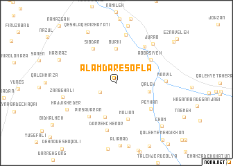
‘Alamdār-e Soflá (Hamadān, Iran)‘Alamdār-e Soflá is a town in the Hamadān region of Iran. An overview map of the region around ‘Alamdār-e Soflá is displayed below.
regional and 3d topo map of ‘Alamdār-e Soflá, Iran ::
‘Alamdār-e Soflá airports ::
The nearest airport is KSH - Bakhtaran Shahid Ashrafi Esfahani, located 154.0 km west of ‘Alamdār-e Soflá.
Other airports nearby include SDG - Sanandaj (204.3 km north west), Nearby towns ::
‘Alamdār-e ‘Olyā (2.6km south west) //
Qal‘eh (4.6km east) //
Būrkī (5.6km north) //
Ordaklū (5.8km south) //
Malīān (6.1km south) //
Bījanābād (5.9km north east) //
‘Abbāsīyeh (5.9km north east) //
Sībdar (6.3km north west) //
Peyhān (6.3km south east) //
Pīr Savārān (6.5km south west) //
Dāvījān (6.9km north east) //
Darreh Chenār (7.8km south) //
Meyābād (7.9km north) //
Marvīl (6.6km east) //
Jūrāb (7.9km north east) //
Ẕarbeh‘alī (7.5km west) //
Ḩājjī Kheder (7.9km south west) //
Qeshlāq-e Pīr Ḩayātī (9.1km north west) //
Cham (9.2km south east) //
[all distances 'as the bird flies' and approximate] 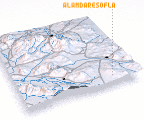 Places with similar names to ‘Alamdār-e Soflá, Iran :: Disclaimer :: Information on this page comes without warranty of any kind |
||
|
Where is ‘Alamdār-e Soflá? Elevation and coordinates ::
Latitude (lat): 34°10'0"N Longitude (lon): 48°49'0"E
Elevation (approx.): 1919m (map arrows pan, magnifying glasses zoom) |
||
|
Visiting ‘Alamdār-e Soflá? Hotel/Accommodation ::
Book a hotel in ‘Alamdār-e Soflá Travel Guide ::
Buy a travel guide for Iran rental cars ::
car rental offers GPS waypoint ::
download a GPX waypoint (PoI) of ‘Alamdār-e Soflá for your GPS receiver
|
||