|
search place name
|
||
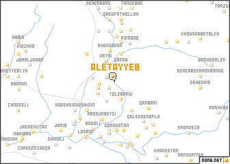
Āl-e Ţayyeb (Khūzestān, Iran)Āl-e Ţayyeb is a town in the Khūzestān region of Iran. An overview map of the region around Āl-e Ţayyeb is displayed below.
regional and 3d topo map of Āl-e Ţayyeb, Iran ::
Āl-e Ţayyeb airports ::
The nearest airport is MRX - Bandar Mahshahr Mahshahr, located 101.7 km west of Āl-e Ţayyeb.
Other airports nearby include AWZ - Ahwaz (151.6 km north west), QMJ - Masjed Soleiman Shahid Asyaee (164.9 km north west), ABD - Abadan (192.7 km west), BUZ - Bushehr (208.7 km south), Nearby towns ::
Borj-e Ḩoseyn Qolī Khān (1.2km south west) //
Gol Zard (1.3km north west) //
Keykāvūs (2.3km west) //
Moḩammad Āqājarī (2.5km west) //
Shah Naz̧arī (2.8km north) //
Garāb (2.9km north) //
Tol-e Bardī (2.9km south) //
Do Dāngeh-ye Kūchek (2.9km south west) //
Do Dāngeh-ye Bozorg (3.3km south) //
Veysī (3.6km north) //
Shahrū'ī (3.2km west) //
Ḩayātābād-e Khalīfeh (4.7km north) //
Ḩayātābād-e Majīdī (4.7km north) //
Āhangarān (5.1km north) //
Asadābād (5.3km south east) //
Manşūr Beygī (6.4km south) //
Borj-e Mollā Valīkhān (6.1km north west) //
Dow Dāngeh (6.1km south west) //
Qal‘eh Tashān (6.5km north) //
Pīrābād (6.7km north) //
Qanbarī (6.4km south east) //
Tākā'īdī (7.4km north) //
Ḩoseynābād-e Āqā (7.8km south) //
Koreh Sīāh-e Shīrīn (7.2km south west) //
Kordestān (7.9km south) //
Qālend-e Soflá (7.7km south east) //
Kālān (8.0km south) //
Kordestān-e Bozorg (8.1km south) //
Koreh Sīāh-e Talkh (7.7km south west) //
[all distances 'as the bird flies' and approximate] 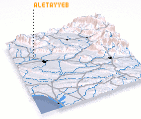 Places with similar names to Āl-e Ţayyeb, Iran ::
// Aldabó (CU)
// Ahlatoba (TR)
// Alitub (RU)
// Aldeia Baia (MZ)
// Aldaba (ES)
// Al ‘Adhbah (QA)
// Aldaba (ES)
// Aldeby (GB)
// Aultbea (GB)
// Aldāba (IN)
Disclaimer :: Information on this page comes without warranty of any kind |
||
|
Where is Āl-e Ţayyeb? Elevation and coordinates ::
Latitude (lat): 30°44'31"N Longitude (lon): 50°11'28"E
Elevation (approx.): 334m (map arrows pan, magnifying glasses zoom) |
||
|
Visiting Āl-e Ţayyeb? Hotel/Accommodation ::
Book a hotel in Āl-e Ţayyeb Travel Guide ::
Buy a travel guide for Iran rental cars ::
car rental offers GPS waypoint ::
download a GPX waypoint (PoI) of Āl-e Ţayyeb for your GPS receiver
|
||