|
search place name
|
||
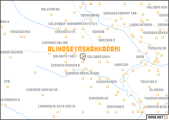
‘Alī Ḩoseyn Shāh Karamī (Lorestān, Iran)‘Alī Ḩoseyn Shāh Karamī is a town in the Lorestān region of Iran. An overview map of the region around ‘Alī Ḩoseyn Shāh Karamī is displayed below.
regional and 3d topo map of ‘Alī Ḩoseyn Shāh Karamī, Iran ::
‘Alī Ḩoseyn Shāh Karamī airports ::
The nearest airport is KSH - Bakhtaran Shahid Ashrafi Esfahani, located 113.4 km north west of ‘Alī Ḩoseyn Shāh Karamī.
Other airports nearby include SDG - Sanandaj (208.3 km north), QMJ - Masjed Soleiman Shahid Asyaee (212.9 km south east), Nearby towns ::
Cheshmeh-ye Karam‘alī (0.5km south west) //
Moḩammad Chenār (1.8km south) //
Do Āb-e Kūr Shūrāb (2.3km south) //
Dūl Gāv-e ‘Alī Ḩoseyn (2.5km south east) //
Kāfar Mosalmān-e Soflá (2.4km north west) //
Moḩammad Chenār (3.0km south west) //
Golābān-e Do (2.8km east) //
Golābān-e Seh (2.8km east) //
Benārkabūd-e Seh (3.5km north) //
Benārkabūd-e Do (3.5km north) //
Heygeh-e Ebrāhīm (4.1km south) //
Kūr Shūrāb-e ‘Alīshāh (4.1km south) //
Qalā‘-e Fatḩ‘alī (3.5km west) //
Bāgh Pīrūz-e Heygah (4.3km south) //
Valīābād-e Chenār (3.7km north west) //
Sarsomāq-e Kālīāb (4.1km south west) //
Zegh-e Kūr Shūrāb (4.1km south west) //
Chenār-e Golābān (1) (4.3km east) //
Benārkabūd-e Yek (5.2km north) //
As̄ar Zamīn-e Kālīāb (4.9km south east) //
Sarzamān (5.4km north east) //
Sohrāb (5.8km north east) //
Heygeh-e Kālīāb (6.1km south) //
Cham-e Dāvūd Chenār (5.3km west) //
Movelah (5.9km south east) //
Yār-e Ḩoseyn (6.2km north west) //
Chenār-e Kālīāb (6.0km north west) //
Sīāh Darreh-ye Seh (7.0km north) //
Sīāh Darreh-ye Yek (7.0km north) //
[all distances 'as the bird flies' and approximate]  Places with similar names to ‘Alī Ḩoseyn Shāh Karamī, Iran :: Disclaimer :: Information on this page comes without warranty of any kind |
||
|
Where is ‘Alī Ḩoseyn Shāh Karamī? Elevation and coordinates ::
Latitude (lat): 33°30'13"N Longitude (lon): 47°51'14"E
Elevation (approx.): 1182m (map arrows pan, magnifying glasses zoom) |
||
|
Visiting ‘Alī Ḩoseyn Shāh Karamī? Hotel/Accommodation ::
Book a hotel in ‘Alī Ḩoseyn Shāh Karamī Travel Guide ::
Buy a travel guide for Iran rental cars ::
car rental offers GPS waypoint ::
download a GPX waypoint (PoI) of ‘Alī Ḩoseyn Shāh Karamī for your GPS receiver
|
||