|
search place name
|
||
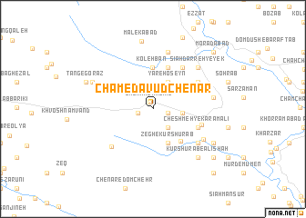
Cham-e Dāvūd Chenār (Lorestān, Iran)Cham-e Dāvūd Chenār is a town in the Lorestān region of Iran. An overview map of the region around Cham-e Dāvūd Chenār is displayed below.
regional and 3d topo map of Cham-e Dāvūd Chenār, Iran ::
Cham-e Dāvūd Chenār airports ::
The nearest airport is KSH - Bakhtaran Shahid Ashrafi Esfahani, located 109.1 km north west of Cham-e Dāvūd Chenār.
Other airports nearby include SDG - Sanandaj (204.7 km north), QMJ - Masjed Soleiman Shahid Asyaee (217.6 km south east), Nearby towns ::
Chenār-e Kālīāb (0.9km north west) //
Valīābād-e Chenār (1.6km east) //
Chenār-e ‘Olyā (1.6km west) //
Qalā‘-e Fatḩ‘alī (2.8km south east) //
Kāfar Mosalmān-e Soflá (3.1km east) //
Yār-e Ḩoseyn (3.6km north east) //
Zegh-e Kūr Shūrāb (4.4km south) //
Sarsomāq-e Kālīāb (4.4km south) //
Shahbāz Beyg (5.1km north) //
Dūl Gāvmīshān (5.1km north) //
Kolehbān (5.1km north) //
Moḩammad Chenār (4.9km south east) //
Mīrḩoseyn (5.3km north) //
Cheshmeh-ye Karam‘alī (5.2km south east) //
‘Alī Ḩoseyn Shāh Karamī (5.3km east) //
Sīāh Darreh-ye Kūchakān (5.9km north east) //
Benārkabūd-e Yek (5.6km north east) //
Bar Āftāb-e Seyyed Moḩammad (6.3km south west) //
Do Āb-e Kūr Shūrāb (6.2km south east) //
Cheshmeh Jamīleh (7.1km north) //
Moḩammad Chenār (6.4km south east) //
Benārkabūd-e Seh (6.3km east) //
Benārkabūd-e Do (6.3km east) //
Sīāh Darreh-ye Seh (6.9km north east) //
Sīāh Darreh-ye Yek (6.9km north east) //
Rashīd (7.0km north west) //
Kūr Shūrāb-e ‘Alīshāh (7.6km south east) //
Heygeh-e Ebrāhīm (7.6km south east) //
Malekābād (8.4km north) //
[all distances 'as the bird flies' and approximate] 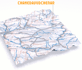 Places with similar names to Cham-e Dāvūd Chenār, Iran :: Disclaimer :: Information on this page comes without warranty of any kind |
||
|
Where is Cham-e Dāvūd Chenār? Elevation and coordinates ::
Latitude (lat): 33°31'15"N Longitude (lon): 47°48'1"E
Elevation (approx.): 1330m (map arrows pan, magnifying glasses zoom) |
||
|
Visiting Cham-e Dāvūd Chenār? Hotel/Accommodation ::
Book a hotel in Cham-e Dāvūd Chenār Travel Guide ::
Buy a travel guide for Iran rental cars ::
car rental offers GPS waypoint ::
download a GPX waypoint (PoI) of Cham-e Dāvūd Chenār for your GPS receiver
|
||