|
search place name
|
||
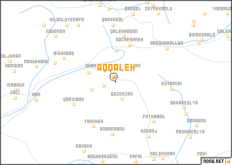
Āq Qal‘eh (Khorāsān, Iran)Āq Qal‘eh is a town in the Khorāsān region of Iran. An overview map of the region around Āq Qal‘eh is displayed below.
regional and 3d topo map of Āq Qal‘eh, Iran ::
Āq Qal‘eh airports ::
The nearest airport is ASB - Ashkhabad Ashgabat, located 120.1 km north of Āq Qal‘eh.
Nearby towns ::
Qūch Qar (1.6km west) //
Shāhzādeh ‘Abd ol Raḩmān (1.9km north) //
Qūzeh Zan (2.8km south) //
Kalāteh-ye Bām (3.3km west) //
Kharq (3.8km north west) //
Ārmūd Āghājī (5.1km north) //
Āq Cheshmeh (6.3km north) //
Qal‘eh Ḩasan (7.5km north) //
Qārzī Bām (6.5km south west) //
Tārkheh (7.7km south) //
‘Anbarābād (8.4km south) //
Fatḩābād (8.1km south east) //
Bīshābād (7.7km north west) //
Bāsh Maḩalleh (8.6km north east) //
Ardanj (9.8km south east) //
[all distances 'as the bird flies' and approximate] 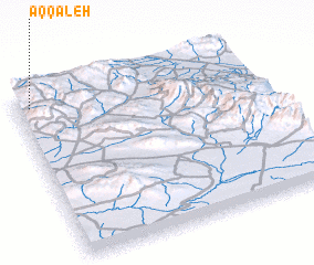 Places with similar names to Āq Qal‘eh, Iran ::
Disclaimer :: Information on this page comes without warranty of any kind |
||
|
Where is Āq Qal‘eh? Elevation and coordinates ::
Latitude (lat): 36°55'59"N Longitude (lon): 58°3'15"E
Elevation (approx.): 1951m (map arrows pan, magnifying glasses zoom) |
||
|
Visiting Āq Qal‘eh? Hotel/Accommodation ::
Book a hotel in Āq Qal‘eh Travel Guide ::
Buy a travel guide for Iran rental cars ::
car rental offers GPS waypoint ::
download a GPX waypoint (PoI) of Āq Qal‘eh for your GPS receiver
|
||