|
search place name
|
||
Bāb ol Balūchī (Kermān, Iran)Bāb ol Balūchī is a town in the Kermān region of Iran. An overview map of the region around Bāb ol Balūchī is displayed below.
regional and 3d topo map of Bāb ol Balūchī, Iran ::

Bāb ol Balūchī airports ::
The nearest airport is KER - Kerman, located 101.0 km south east of Bāb ol Balūchī.
Nearby towns ::
Rashk-e Bālā (1.9km south) //
Rashk-e Mīān (1.9km south) //
Rashk-e Pāʼīn (2.4km south west) //
Hezārgaz (3.2km west) //
Seh Botk (3.7km north west) //
Bāb-e ‘Abdān (4.4km south) //
Āb Chekū (4.9km south east) //
Deh-e ‘Abbās-e Kalmoḩammad (5.8km north) //
Zārchū (5.1km east) //
Shamsābād (6.4km south east) //
Khvāh Makān (6.0km north west) //
Gowdū (6.0km north east) //
Hanjarū'īyeh (7.3km south east) //
Tūt-e Bīdū (7.4km north east) //
Dar-e Ḩūdk (8.4km south east) //
Bāghhā-ye Sar Āsīāb (8.8km north west) //
Khān Makān (8.4km south west) //
Dehnū-ye Pā'īn (8.8km north east) //
Korīkū'īyeh-e Bālā (8.8km north east) //
Shahrak-e Pābedānā (8.7km north west) //
Tītū Jalāl (9.8km south east) //
Gechīl-e Bālā (9.8km north east) //
Ţoghr ol Jerd (11.0km north west) //
[all distances 'as the bird flies' and approximate] 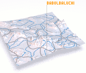 Places with similar names to Bāb ol Balūchī, Iran :: Disclaimer :: Information on this page comes without warranty of any kind |
||
|
Where is Bāb ol Balūchī? Elevation and coordinates ::
Latitude (lat): 31°5'0"N Longitude (lon): 56°28'0"E
Elevation (approx.): 2090m (map arrows pan, magnifying glasses zoom) |
||
|
Visiting Bāb ol Balūchī? Hotel/Accommodation ::
Book a hotel in Bāb ol Balūchī Travel Guide ::
Buy a travel guide for Iran rental cars ::
car rental offers GPS waypoint ::
download a GPX waypoint (PoI) of Bāb ol Balūchī for your GPS receiver
|
||