|
search place name
|
||
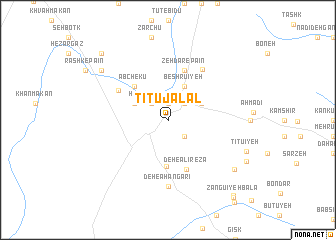
Tītū Jalāl (Iran)Tītū Jalāl is a town in Iran. An overview map of the region around Tītū Jalāl is displayed below.
regional and 3d topo map of Tītū Jalāl, Iran ::
Tītū Jalāl airports ::
The nearest airport is KER - Kerman, located 91.5 km south east of Tītū Jalāl.
Nearby towns ::
Dar-e Ḩūdk (1.9km north) //
Hanjarū'īyeh (2.4km north west) //
Kowsar (2.4km north east) //
Deh-e ‘Abbās (2.4km north east) //
Deh-e Khodādād (2.4km north east) //
Gowd-e Rīg (2.4km south east) //
Shamsābād (3.7km north west) //
Bābdūrī (4.0km north east) //
Beshrūʼīyeh (4.0km north east) //
Bashrū'īyeh (4.0km north east) //
Gāshkūh (3.7km north east) //
Deh Zū'īyeh (5.2km south) //
Āb Chekū (4.9km north west) //
Gordūn (5.8km north) //
Zehdar-e Pā'īn (5.8km north) //
Deh-e ‘Alī Reẕā (5.8km south) //
Bāb-e ‘Abdān (5.8km north west) //
Dasht-e Khāk (6.5km north east) //
Deh-e Āhangarī (7.4km south) //
Rashk-e Mīān (8.4km north west) //
Rashk-e Bālā (8.4km north west) //
Patkūʼīyeh (8.4km south east) //
Tītū'īyeh (8.3km south east) //
Bābkhowshāb (8.3km south east) //
Sabanū'īyeh (8.8km south east) //
Bāb ol Balūchī (9.8km north west) //
Aḩmaqān-e Pā'īn (10.5km south east) //
Zangū'īyeh Bālā (10.7km south east) //
[all distances 'as the bird flies' and approximate] 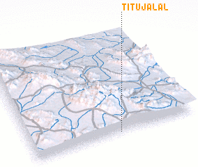 Places with similar names to Tītū Jalāl, Iran :: Disclaimer :: Information on this page comes without warranty of any kind |
||
|
Where is Tītū Jalāl? Elevation and coordinates ::
Latitude (lat): 31°1'0"N Longitude (lon): 56°32'0"E
Elevation (approx.): 2198m (map arrows pan, magnifying glasses zoom) |
||
|
Visiting Tītū Jalāl? Hotel/Accommodation ::
Book a hotel in Tītū Jalāl Travel Guide ::
Buy a travel guide for Iran rental cars ::
car rental offers GPS waypoint ::
download a GPX waypoint (PoI) of Tītū Jalāl for your GPS receiver
|
||