|
search place name
|
||
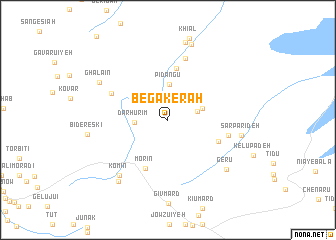
Begākerāh (Kermān, Iran)Begākerāh is a town in the Kermān region of Iran. An overview map of the region around Begākerāh is displayed below.
regional and 3d topo map of Begākerāh, Iran ::
Begākerāh airports ::
The nearest airport is KER - Kerman, located 188.1 km north west of Begākerāh.
Other airports nearby include BND - Bandar Abbass Intl (252.1 km south west), Nearby towns ::
Gowk (3.0km east) //
Dar Hūrīm (3.3km west) //
Pīdangū (4.0km north) //
Bāgh Tak (3.6km east) //
Boneh-ye Heykal (3.7km north west) //
Tītūbar (5.8km north) //
Morīn (5.9km south) //
Dozrū (5.5km south east) //
Hīr Kūhī (6.2km north west) //
Derzerb (6.1km east) //
Kan Gīnow (7.0km north) //
Komīn (7.8km south west) //
Sar Parīdeh (7.4km east) //
Gerū (7.9km south east) //
Ghalā'īn (7.9km north west) //
Kangerow (8.7km north) //
Rūmīn (8.4km south west) //
Āb Garm (8.9km north) //
Khīārū (8.9km north) //
[all distances 'as the bird flies' and approximate] 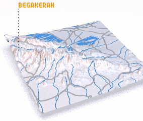 Places with similar names to Begākerāh, Iran ::
// Bocacara (ES)
// Beccaria (US)
// Bāg Āchra (BD)
// Békagourou (CF)
// Bokakre (GH)
// Bokaukre (GH)
// Bokokre (GH)
// Bokukrua (GH)
// Boukagorou (NE)
// Bakokoro (GN)
Disclaimer :: Information on this page comes without warranty of any kind |
||
|
Where is Begākerāh? Elevation and coordinates ::
Latitude (lat): 28°54'19"N Longitude (lon): 58°5'56"E
Elevation (approx.): 2086m (map arrows pan, magnifying glasses zoom) |
||
|
Visiting Begākerāh? Hotel/Accommodation ::
Book a hotel in Begākerāh Travel Guide ::
Buy a travel guide for Iran rental cars ::
car rental offers GPS waypoint ::
download a GPX waypoint (PoI) of Begākerāh for your GPS receiver
|
||