|
search place name
|
||
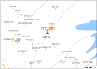
Tītūbar (Kermān, Iran)Tītūbar is a town in the Kermān region of Iran. An overview map of the region around Tītūbar is displayed below.
regional and 3d topo map of Tītūbar, Iran ::
Tītūbar airports ::
The nearest airport is KER - Kerman, located 184.1 km north west of Tītūbar.
Other airports nearby include BND - Bandar Abbass Intl (256.9 km south west), Nearby towns ::
Kan Gīnow (1.4km north east) //
Pīdangū (1.9km south west) //
Āb Garm (3.1km north) //
Khīārū (3.1km north) //
Kangerow (3.0km north east) //
Khīāl (3.6km north) //
Bāgh Tak (5.1km south east) //
Gowk (5.2km south) //
Boneh-ye Heykal (5.3km south west) //
Begākerāh (5.8km south) //
Dar Hūrīm (7.3km south west) //
Hīr Kūhī (6.9km south west) //
Āb Garm-e Seyyedī (7.5km north west) //
Ghalā'īn (7.7km west) //
Derzerb (9.0km south east) //
Dozrū (9.1km south east) //
Derījān (9.5km north west) //
Sar Parīdeh (9.8km south east) //
[all distances 'as the bird flies' and approximate] 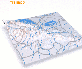 Places with similar names to Tītūbar, Iran ::
// Dattabāri (BD)
// Tāttibāri (BD)
// Dadubere (TP)
// Tatabaoria (TP)
// Titibauria (TP)
// Dudāberi (IN)
// Titābar (IN)
// Tedubara (ID)
// Dadabiri (NG)
// Tetbury (GB)
Disclaimer :: Information on this page comes without warranty of any kind |
||
|
Where is Tītūbar? Elevation and coordinates ::
Latitude (lat): 28°57'24"N Longitude (lon): 58°6'28"E
Elevation (approx.): 1699m (map arrows pan, magnifying glasses zoom) |
||
|
Visiting Tītūbar? Hotel/Accommodation ::
Book a hotel in Tītūbar Travel Guide ::
Buy a travel guide for Iran rental cars ::
car rental offers GPS waypoint ::
download a GPX waypoint (PoI) of Tītūbar for your GPS receiver
|
||