|
search place name
|
||
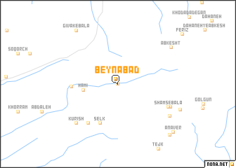
Beynābād (Khorāsān, Iran)Beynābād is a town in the Khorāsān region of Iran. An overview map of the region around Beynābād is displayed below.
regional and 3d topo map of Beynābād, Iran ::
Beynābād airports ::
The nearest airport is XBJ - Birjand, located 53.9 km east of Beynābād.
Nearby towns ::
Ark (0.0km west) //
Kāmi (4.7km west) //
Ḩāmī (4.7km west) //
Selk (6.7km south) //
Dahan Rūd (6.2km west) //
Morghūk (7.4km south west) //
Shams-e Bālā (7.7km south east) //
Kūrīsh (8.4km south west) //
Kalāteh-ye Shams (8.0km south east) //
Shams-e Pā'īn (8.6km south east) //
Ābkesht (9.1km north east) //
Gīvak-e Bālā (10.1km north west) //
‘Anābīyeh (10.7km south east) //
Anāver (10.7km south east) //
[all distances 'as the bird flies' and approximate]  Places with similar names to Beynābād, Iran ::
// Baunu” Bata” (PH)
// Ban Ai Bu Tae (TH)
// Ban Ba Do (TH)
// Ban Boet (TH)
// Ban Boet (TH)
// Ban Bo It (TH)
// Ban Bot (TH)
// Ban Bot (TH)
// Ban Bot (TH)
// Ban Bo To (TH)
Disclaimer :: Information on this page comes without warranty of any kind |
||
|
Where is Beynābād? Elevation and coordinates ::
Latitude (lat): 33°1'24"N Longitude (lon): 58°42'32"E
Elevation (approx.): 1676m (map arrows pan, magnifying glasses zoom) |
||
|
Visiting Beynābād? Hotel/Accommodation ::
Book a hotel in Beynābād Travel Guide ::
Buy a travel guide for Iran rental cars ::
car rental offers GPS waypoint ::
download a GPX waypoint (PoI) of Beynābād for your GPS receiver
|
||