|
search place name
|
||
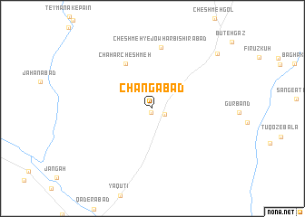
Changābād (Khorāsān, Iran)Changābād is a town in the Khorāsān region of Iran. An overview map of the region around Changābād is displayed below.
regional and 3d topo map of Changābād, Iran ::
Changābād airports ::
The nearest airport is HEA - Herat, located 191.3 km south east of Changābād.
Nearby towns ::
Kalāteh-ye Allāh Resān (0.6km south) //
Cheshmeh Gol (1.4km south east) //
Chahār Cheshmeh (6.1km north west) //
Cheshmeh-ye Jowhar Bīshīrābād (7.6km north) //
Yakhak (9.4km north east) //
[all distances 'as the bird flies' and approximate] 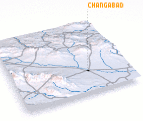 Places with similar names to Changābād, Iran ::
// Shān Kabūd (IR)
// Chong Bát (VN)
// Shangbutou (CN)
// Shangbutou (CN)
// Shangbutou (CN)
// Shuangbaidu (CN)
// Shuangbutou (CN)
Disclaimer :: Information on this page comes without warranty of any kind |
||
|
Where is Changābād? Elevation and coordinates ::
Latitude (lat): 35°22'48"N Longitude (lon): 60°41'31"E
Elevation (approx.): 1052m (map arrows pan, magnifying glasses zoom) |
||
|
Visiting Changābād? Hotel/Accommodation ::
Book a hotel in Changābād Travel Guide ::
Buy a travel guide for Iran rental cars ::
car rental offers GPS waypoint ::
download a GPX waypoint (PoI) of Changābād for your GPS receiver
|
||