|
search place name
|
||
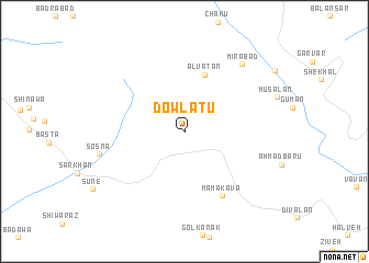
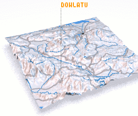
Dowlatū (Ostān-e Āz̄arbāyjān-e Sharqī, Iran)Dowlatū is a town in the Ostān-e Āz̄arbāyjān-e Sharqī region of Iran. An overview map of the region around Dowlatū is displayed below.
regional and 3d topo map of Dowlatū, Iran ::
Dowlatū airports ::
The nearest airport is SDG - Sanandaj, located 195.6 km south east of Dowlatū.
Other airports nearby include TBZ - Tabriz Intl (214.6 km north), KSH - Bakhtaran Shahid Ashrafi Esfahani (277.8 km south east), Nearby towns ::
 Places with similar names to Dowlatū, Iran ::
Disclaimer :: Information on this page comes without warranty of any kind |
||
|
Where is Dowlatū? Elevation and coordinates ::
Latitude (lat): 36°20'41"N Longitude (lon): 45°19'2"E
Elevation (approx.): 1888m (map arrows pan, magnifying glasses zoom) |
||
|
Visiting Dowlatū? Hotel/Accommodation ::
Book a hotel in Dowlatū Travel Guide ::
Buy a travel guide for Iran rental cars ::
car rental offers GPS waypoint ::
download a GPX waypoint (PoI) of Dowlatū for your GPS receiver
|
||