|
search place name
|
||
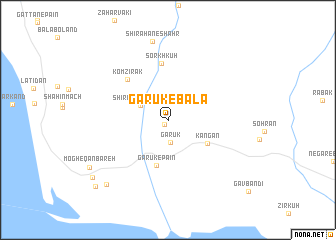
Garūk-e Bālā (Hormozgān, Iran)Garūk-e Bālā is a town in the Hormozgān region of Iran. An overview map of the region around Garūk-e Bālā is displayed below.
regional and 3d topo map of Garūk-e Bālā, Iran ::
Garūk-e Bālā airports ::
The nearest airport is KHS - Khasab, located 122.5 km west of Garūk-e Bālā.
Other airports nearby include FJR - Fujeirah Fujairah Intl (139.7 km south west), RKT - Ras Al Khaimah Intl (151.9 km west), BND - Bandar Abbass Intl (180.7 km north west), SHJ - Sharjah Intl (201.1 km west), Nearby towns ::
Kolrīg (0.6km south west) //
Garūk (2.5km south) //
Shīrāhan-e Bīsheh (3.2km north west) //
Kangān (4.7km south east) //
Garūk-e Pā'īn (5.2km south) //
Sorkh Kūh (6.3km north) //
Komzīrak (6.1km north west) //
Shīrāhan-e Shahr (8.8km north) //
Sangārī Mach (9.5km south west) //
Mogh-e Qanbareh (9.5km south west) //
Kūh-e Mobārak (10.0km south west) //
Mogh-e Mālūm (10.4km south west) //
[all distances 'as the bird flies' and approximate] 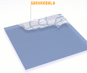 Places with similar names to Garūk-e Bālā, Iran ::
// Krakebüll (DE)
// Guaracabulla (CU)
// Çarıkballı (TR)
// Kurucabel (TR)
// Carcabal (ES)
// Gargaboulli (BF)
// Korkobièl (BF)
// Koragbal (IN)
// Corre Caballo (MX)
// Qoroq-e Bālā (IR)
Disclaimer :: Information on this page comes without warranty of any kind |
||
|
Where is Garūk-e Bālā? Elevation and coordinates ::
Latitude (lat): 25°53'5"N Longitude (lon): 57°25'21"E
Elevation (approx.): 24m (map arrows pan, magnifying glasses zoom) |
||
|
Visiting Garūk-e Bālā? Hotel/Accommodation ::
Book a hotel in Garūk-e Bālā Travel Guide ::
Buy a travel guide for Iran rental cars ::
car rental offers GPS waypoint ::
download a GPX waypoint (PoI) of Garūk-e Bālā for your GPS receiver
|
||