|
search place name
|
||
Guaracabulla (Villa Clara, Cuba)Guaracabulla is a town in the Villa Clara region of Cuba. An overview map of the region around Guaracabulla is displayed below.
regional and 3d topo map of Guaracabulla, Cuba ::

Guaracabulla airports ::
The nearest airport is SNU - Santa Clara Abel Santamaria, located 33.1 km north west of Guaracabulla.
Other airports nearby include CFG - Cienfuegos Jaime Gonzalez (71.4 km west), AVI - Ciego De Avila Maximo Gomez (100.9 km east), VRA - Varadero Juan Gualberto Gomez Intl (194.5 km north west), CYO - Cayo Vilo Acuna Intl (200.6 km west), Nearby towns ::
La Caridad (1.7km west) //
Ojo de Agua (2.5km south west) //
Jagüeyes Abajo (4.1km north east) //
Alcantarilla (5.5km west) //
Báez (6.0km south) //
Cumbre (6.3km north east) //
Oliver (7.4km north) //
El Mamey (7.6km north) //
Minas Bajas (7.6km south) //
Lotería (7.6km south) //
Naranjito (7.6km south east) //
Cascaja (7.6km north east) //
Placetas (9.6km north east) //
La Retenida (10.1km north east) //
[all distances 'as the bird flies' and approximate] 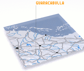 Places with similar names to Guaracabulla, Cuba ::
// Krakebüll (DE)
// Çarıkballı (TR)
// Kurucabel (TR)
// Carcabal (ES)
// Gargaboulli (BF)
// Korkobièl (BF)
// Koragbal (IN)
// Corre Caballo (MX)
// Garūk-e Bālā (IR)
// Qoroq-e Bālā (IR)
Disclaimer :: Information on this page comes without warranty of any kind |
||
|
Where is Guaracabulla? Elevation and coordinates ::
Latitude (lat): 22°16'0"N Longitude (lon): 79°44'0"W
Elevation (approx.): 177m (map arrows pan, magnifying glasses zoom) |
||
|
Visiting Guaracabulla? Hotel/Accommodation ::
Book a hotel in Guaracabulla Travel Guide ::
Buy a travel guide for Cuba rental cars ::
car rental offers GPS waypoint ::
download a GPX waypoint (PoI) of Guaracabulla for your GPS receiver
|
||