|
search place name
|
||
Ḩojjatābād (Kermān, Iran)Ḩojjatābād is a town in the Kermān region of Iran. An overview map of the region around Ḩojjatābād is displayed below.
regional and 3d topo map of Ḩojjatābād, Iran ::

Ḩojjatābād airports ::
The nearest airport is BND - Bandar Abbass Intl, located 197.9 km south west of Ḩojjatābād.
Other airports nearby include KER - Kerman (222.4 km north west), Nearby towns ::
‘Alīābād (0.9km north) //
Ḩoseynābād (1.5km south) //
Lard Kharān (2.2km north) //
Amīrābād (2.4km south east) //
‘Anbarābād (2.5km south west) //
Yūsefābād (2.7km north west) //
Manşūrīyeh (3.0km north west) //
Karīmābād (3.0km north west) //
Tavakolābād-e Pā'īn (3.1km north west) //
Raḩmatābād (3.6km south) //
Allāhābād (3.9km south west) //
Ḩājjīābād (3.6km west) //
Deh Now (3.6km west) //
‘Abbāsābād (4.1km north) //
Ḩamīdābād (3.8km west) //
Ḩājjīābād (4.4km south east) //
Khātūnābād (4.6km west) //
Mokhtārābād (5.2km north) //
M'ayatābād (4.8km north west) //
Anūzābād (5.3km north) //
Dehnow (5.4km south) //
Maţūţābād (5.4km north west) //
‘Abdollāhābād (5.7km south) //
Ḩoseynābād-e Lūlī (5.8km north west) //
Tall-e Shīrāz (5.7km south east) //
Karam Shan (5.7km south east) //
Khar Posht (6.8km north east) //
Jalīlābād (6.4km east) //
Mahdābād (7.3km south) //
[all distances 'as the bird flies' and approximate] 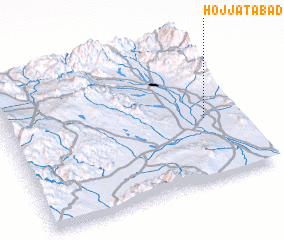 Places with similar names to Ḩojjatābād, Iran ::
// Ḩojjatābād (IR)
// Ḩojjatābād (IR)
// Ḩojjatābād (IR)
// Ḩojjatābād (IR)
// Ḩojjatābād (IR)
// Ḩojjatābād (IR)
// Ḩojjatābād (IR)
// Ḩojjatābād (IR)
// Ḩojjatābād (IR)
// Ḩojjatābād (IR)
Disclaimer :: Information on this page comes without warranty of any kind |
||
|
Where is Ḩojjatābād? Elevation and coordinates ::
Latitude (lat): 28°25'48"N Longitude (lon): 57°51'12"E
Elevation (approx.): 598m (map arrows pan, magnifying glasses zoom) |
||
|
Visiting Ḩojjatābād? Hotel/Accommodation ::
Book a hotel in Ḩojjatābād Travel Guide ::
Buy a travel guide for Iran rental cars ::
car rental offers GPS waypoint ::
download a GPX waypoint (PoI) of Ḩojjatābād for your GPS receiver
|
||