|
search place name
|
||
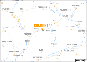
Kal Akhtar (Khorāsān, Iran)Kal Akhtar is a town in the Khorāsān region of Iran. An overview map of the region around Kal Akhtar is displayed below.
regional and 3d topo map of Kal Akhtar, Iran ::
Kal Akhtar airports ::
The nearest airport is ASB - Ashkhabad Ashgabat, located 138.1 km north of Kal Akhtar.
Nearby towns ::
Daraq (2.3km west) //
Qezel Qal‘eh (2.9km east) //
Ebrāhīmābād (3.6km south west) //
Zīg (5.1km north east) //
‘Abbāsābād (5.5km south west) //
Ebrāhīm Gol (5.7km north east) //
Ţālebī (7.6km south east) //
Kūh Darreh (6.9km west) //
Kūshk (7.6km south west) //
Dīvāngāh (7.6km south west) //
Sīmān (6.9km west) //
Kheder Shāh (9.2km north) //
Rostamābād (8.9km north east) //
[all distances 'as the bird flies' and approximate] 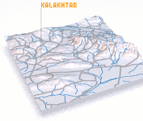 Places with similar names to Kal Akhtar, Iran ::
// Kılıçdere (TR)
// Koulkadouri (BJ)
// Gouli Godiaré (BF)
// Kilakkettara (IN)
// Kalak Darreh (IR)
// Kaleh Qaţār (IR)
// Kaleh Qaţār (IR)
// Kalgā Darreh (IR)
// Kal Godār (IR)
// Gul Akhtar (PK)
Disclaimer :: Information on this page comes without warranty of any kind |
||
|
Where is Kal Akhtar? Elevation and coordinates ::
Latitude (lat): 36°44'42"N Longitude (lon): 58°15'50"E
Elevation (approx.): 1635m (map arrows pan, magnifying glasses zoom) |
||
|
Visiting Kal Akhtar? Hotel/Accommodation ::
Book a hotel in Kal Akhtar Travel Guide ::
Buy a travel guide for Iran rental cars ::
car rental offers GPS waypoint ::
download a GPX waypoint (PoI) of Kal Akhtar for your GPS receiver
|
||