|
search place name
|
||
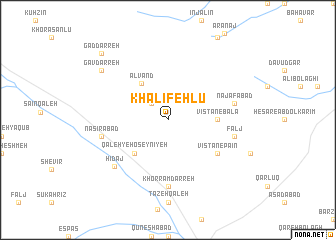
Khalīfehlū (Iran)Khalīfehlū is a town in Iran. An overview map of the region around Khalīfehlū is displayed below.
regional and 3d topo map of Khalīfehlū, Iran ::
Khalīfehlū airports ::
The nearest airport is RAS - Rasht, located 121.2 km north of Khalīfehlū.
Other airports nearby include RZR - Ramsar (149.5 km north east), Nearby towns ::
Pelās (2.4km north west) //
Alvand (4.8km north west) //
Qal‘eh-ye Ḩoseynīyeh (4.8km south west) //
Vīstān-e Bālā (4.5km east) //
Vīstān-e Pāʼīn (5.8km south east) //
Khorram Darreh (7.4km south) //
Falj (6.3km east) //
Khalaj (6.3km east) //
Naşīrābād (6.3km west) //
Najafābād (6.3km east) //
Hīdaj (7.1km south west) //
Gāv Darreh (8.2km north west) //
Gād Darreh (9.5km north west) //
[all distances 'as the bird flies' and approximate] 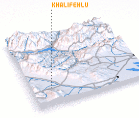 Places with similar names to Khalīfehlū, Iran ::
// Khalafli (AZ)
// Khalaflū (IR)
// Khalīfehlū (IR)
// Khalīfehlū (IR)
// Khalīfehlū (IR)
// Khalīfehlū (IR)
// Khalfallah (DZ)
Disclaimer :: Information on this page comes without warranty of any kind |
||
|
Where is Khalīfehlū? Elevation and coordinates ::
Latitude (lat): 36°17'0"N Longitude (lon): 49°12'0"E
Elevation (approx.): 1774m (map arrows pan, magnifying glasses zoom) |
||
|
Visiting Khalīfehlū? Hotel/Accommodation ::
Book a hotel in Khalīfehlū Travel Guide ::
Buy a travel guide for Iran rental cars ::
car rental offers GPS waypoint ::
download a GPX waypoint (PoI) of Khalīfehlū for your GPS receiver
|
||