|
search place name
|
||
Khalīfehlū (Ostān-e Āz̄arbāyjān-e Sharqī, Iran)Khalīfehlū is a town in the Ostān-e Āz̄arbāyjān-e Sharqī region of Iran. An overview map of the region around Khalīfehlū is displayed below.
regional and 3d topo map of Khalīfehlū, Iran ::

Khalīfehlū airports ::
The nearest airport is TBZ - Tabriz Intl, located 146.8 km north east of Khalīfehlū.
Other airports nearby include SDG - Sanandaj (228.1 km south east), Nearby towns ::
Qomlū (1.2km south) //
Qareh Qaşşāb (2.7km north) //
Chaqāl-e Moşţafá (3.3km south) //
Gūrkhāneh (3.0km south east) //
Nez̧āmābād (3.5km north west) //
Sākhasī Tappeh (3.3km west) //
Tāzeh Kand-e Bolbol (4.7km north) //
Panj Tan-e Shahīd (5.1km south) //
Darakeh-ye Oros Khān (5.1km north east) //
Farokhzād (5.3km north west) //
Āqţavīleh (6.4km north) //
Shahīd Moḩammad Ra'ūf (6.9km south) //
Moḩammad Yār (7.1km north west) //
Moḩammad Yār (8.2km north) //
Darakeh-ye Loţfollāh (7.2km north east) //
Āqā Beyglū (7.6km north west) //
Beygom Qal‘eh (7.1km west) //
Shatqār (8.8km north west) //
Qāẕī Gol (8.7km south east) //
[all distances 'as the bird flies' and approximate] 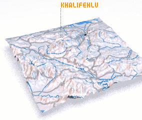 Places with similar names to Khalīfehlū, Iran ::
// Khalafli (AZ)
// Khalaflū (IR)
// Khalīfehlū (IR)
// Khalīfehlū (IR)
// Khalīfehlū (IR)
// Khalīfehlū (IR)
// Khalfallah (DZ)
Disclaimer :: Information on this page comes without warranty of any kind |
||
|
Where is Khalīfehlū? Elevation and coordinates ::
Latitude (lat): 36°55'39"N Longitude (lon): 45°33'10"E
Elevation (approx.): 1294m (map arrows pan, magnifying glasses zoom) |
||
|
Visiting Khalīfehlū? Hotel/Accommodation ::
Book a hotel in Khalīfehlū Travel Guide ::
Buy a travel guide for Iran rental cars ::
car rental offers GPS waypoint ::
download a GPX waypoint (PoI) of Khalīfehlū for your GPS receiver
|
||