|
search place name
|
||
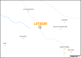
Latadar (Iran)Latadar is a town in Iran. An overview map of the region around Latadar is displayed below.
regional and 3d topo map of Latadar, Iran ::
Latadar airports ::
The nearest airport is THR - Teheran Mehrabad Intl, located 217.0 km north east of Latadar.
Other airports nearby include QMJ - Masjed Soleiman Shahid Asyaee (235.2 km south), Nearby towns ::
Anjedān (8.0km south west) //
Lateh Darreh (9.4km north west) //
[all distances 'as the bird flies' and approximate] 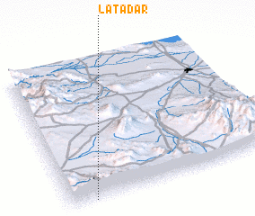 Places with similar names to Latadar, Iran ::
// La Teodora (PA)
// La Auditoría (ES)
// Laditra (MG)
// La Tetera (CL)
// Lauttador (ID)
// Lotuturu (UG)
// Lateh Darreh (IR)
// Le Tâtre (FR)
// Le Titre (FR)
// La Totora (AR)
Disclaimer :: Information on this page comes without warranty of any kind |
||
|
Where is Latadar? Elevation and coordinates ::
Latitude (lat): 34°0'0"N Longitude (lon): 50°7'0"E
Elevation (approx.): 2240m (map arrows pan, magnifying glasses zoom) |
||
|
Visiting Latadar? Hotel/Accommodation ::
Book a hotel in Latadar Travel Guide ::
Buy a travel guide for Iran rental cars ::
car rental offers GPS waypoint ::
download a GPX waypoint (PoI) of Latadar for your GPS receiver
|
||