|
search place name
|
||
Māzūposhteh (Iran)Māzūposhteh is a town in Iran. An overview map of the region around Māzūposhteh is displayed below.
regional and 3d topo map of Māzūposhteh, Iran ::

Māzūposhteh airports ::
The nearest airport is RZR - Ramsar, located 71.3 km north west of Māzūposhteh.
Other airports nearby include THR - Teheran Mehrabad Intl (105.1 km south), RAS - Rasht (177.2 km north west), Nearby towns ::
‘Alīābād-e Chālūs (0.0km north) //
‘Alīābād-e Dārkolā (1.9km north) //
Kharmaneh (1.9km north) //
Moḩammad Sheykh ol Eslāmī (1.5km east) //
Kordkhīl (1.9km north) //
Z̄avāt-e Sharq (1.8km west) //
Sīnavā (1.9km south west) //
Shāh Cheshmeh (2.4km south west) //
Sīnavā Cheshmeh (2.4km south west) //
Ţalājū (2.4km south west) //
Dārmīsh Kola (2.4km north east) //
Tejen Kolā (2.4km north west) //
Chālūs (3.1km north east) //
‘Arab Kheyl (3.5km north west) //
Eshkārdasht (3.0km east) //
‘Olvī Kolā (3.7km north) //
Z̄avāt-e Gharb (3.3km north west) //
Sar Cheshmeh (4.0km south) //
Karīmābād (3.5km north west) //
Kīl-e Kolā (4.0km north) //
Sardab Rūd (4.3km north) //
Ne‘matābād (4.8km north west) //
Pījīdeh (4.8km north west) //
Sepīdeh (4.8km north west) //
Najjār Kolā (4.8km north west) //
Kelāchān (4.8km north west) //
Faraḩābād (4.8km north east) //
Gorāmjān va Salīmābād (4.8km north east) //
Ābrang (4.8km north east) //
[all distances 'as the bird flies' and approximate] 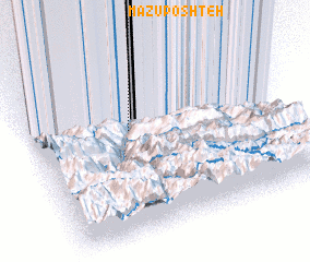 Places with similar names to Māzūposhteh, Iran ::
// Māzū Poshteh (IR)
Disclaimer :: Information on this page comes without warranty of any kind |
||
|
Where is Māzūposhteh? Elevation and coordinates ::
Latitude (lat): 36°38'0"N Longitude (lon): 51°24'0"E
Elevation (approx.): 122m (map arrows pan, magnifying glasses zoom) |
||
|
Visiting Māzūposhteh? Hotel/Accommodation ::
Book a hotel in Māzūposhteh Travel Guide ::
Buy a travel guide for Iran rental cars ::
car rental offers GPS waypoint ::
download a GPX waypoint (PoI) of Māzūposhteh for your GPS receiver
|
||