|
search place name
|
||
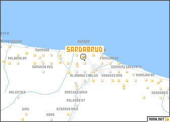
Sardab Rūd (Iran)Sardab Rūd is a town in Iran. An overview map of the region around Sardab Rūd is displayed below.
regional and 3d topo map of Sardab Rūd, Iran ::
Sardab Rūd airports ::
The nearest airport is RZR - Ramsar, located 69.5 km north west of Sardab Rūd.
Other airports nearby include THR - Teheran Mehrabad Intl (109.3 km south), RAS - Rasht (175.4 km north west), Nearby towns ::
‘Olvī Kolā (0.6km south) //
Kīl-e Kolā (1.6km west) //
‘Arab Kheyl (1.7km south west) //
Ūjā Kolā (2.0km north west) //
Sardārābād (2.0km north west) //
Dūjmān (2.0km north west) //
Mīān Deh (2.0km north west) //
Āyeshbon-e Soflá (2.0km north east) //
Āyeshbon-e ‘Olyā (2.0km north east) //
‘Abbās Kolā (2.0km north west) //
Kordkhīl (2.4km south) //
Kharmaneh (2.4km south) //
‘Alīābād-e Dārkolā (2.4km south) //
Tejen Kolā (2.8km south west) //
Dārmīsh Kola (2.8km south east) //
Chālūs (2.7km south east) //
Būrsar (3.2km north) //
Najjār Kolā (3.0km west) //
Kelāchān (3.0km west) //
Sepīdeh (3.0km west) //
Ne‘matābād (3.0km west) //
Pījīdeh (3.0km west) //
Gorāmjān va Salīmābād (3.0km east) //
Ābrang (3.0km east) //
Faraḩābād (3.0km east) //
Tāzehābād (3.2km north east) //
Moslemābād (3.2km north east) //
Māzūposhteh (4.3km south) //
‘Alīābād-e Chālūs (4.3km south) //
[all distances 'as the bird flies' and approximate]  Places with similar names to Sardab Rūd, Iran ::
// Sardābrūd (IR)
Disclaimer :: Information on this page comes without warranty of any kind |
||
|
Where is Sardab Rūd? Elevation and coordinates ::
Latitude (lat): 36°40'18"N Longitude (lon): 51°24'0"E
Elevation (approx.): -2m (map arrows pan, magnifying glasses zoom) |
||
|
Visiting Sardab Rūd? Hotel/Accommodation ::
Book a hotel in Sardab Rūd Travel Guide ::
Buy a travel guide for Iran rental cars ::
car rental offers GPS waypoint ::
download a GPX waypoint (PoI) of Sardab Rūd for your GPS receiver
|
||