|
search place name
|
||
Monjar Mūʼī (Chahār Maḩāll va Bakhtīār, Iran)Monjar Mūʼī is a town in the Chahār Maḩāll va Bakhtīār region of Iran. An overview map of the region around Monjar Mūʼī is displayed below.
regional and 3d topo map of Monjar Mūʼī, Iran ::

Monjar Mūʼī airports ::
The nearest airport is QMJ - Masjed Soleiman Shahid Asyaee, located 162.9 km west of Monjar Mūʼī.
Other airports nearby include MRX - Bandar Mahshahr Mahshahr (194.9 km south west), SYZ - Shiraz Shahid Dastghaib Intl (271.3 km south east), Nearby towns ::
Zarrīn Derakht (4.7km north west) //
Jān Nesā' (5.2km north) //
Sar Khowr Pā”īn (5.5km north west) //
Tūtang (6.3km north) //
Lordegān (5.5km north west) //
Tang-e Do Shalvārī (6.6km north) //
Darakeh (6.4km north east) //
Tang Kolūreh (6.8km north) //
Bar Āftāb-e Khong (6.8km north east) //
Kohyān (6.8km south east) //
Bar Āftāb-e Sabzevār-e Darakeh (7.1km north east) //
Sar Khowr Bālā (6.9km north west) //
Khārdān (7.0km north west) //
Shīrānī (7.1km north west) //
Shesh Bahreh ‘Olyā (7.0km west) //
Bar Āftāb-e Shīdān (7.7km north west) //
Chāh Gāh (9.8km north east) //
Kal Gachī (9.5km north west) //
[all distances 'as the bird flies' and approximate] 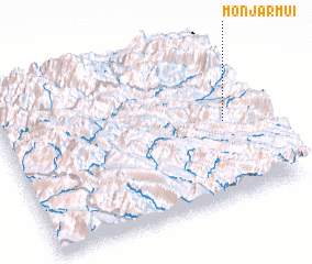 Places with similar names to Monjar Mūʼī, Iran ::
// Mānjram (IN)
Disclaimer :: Information on this page comes without warranty of any kind |
||
|
Where is Monjar Mūʼī? Elevation and coordinates ::
Latitude (lat): 31°29'21"N Longitude (lon): 50°52'54"E
Elevation (approx.): 1703m (map arrows pan, magnifying glasses zoom) |
||
|
Visiting Monjar Mūʼī? Hotel/Accommodation ::
Book a hotel in Monjar Mūʼī Travel Guide ::
Buy a travel guide for Iran rental cars ::
car rental offers GPS waypoint ::
download a GPX waypoint (PoI) of Monjar Mūʼī for your GPS receiver
|
||