|
search place name
|
||
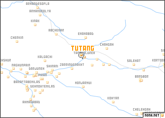
Tūtang (Chahār Maḩāll va Bakhtīār, Iran)Tūtang is a town in the Chahār Maḩāll va Bakhtīār region of Iran. An overview map of the region around Tūtang is displayed below.
regional and 3d topo map of Tūtang, Iran ::
Tūtang airports ::
The nearest airport is QMJ - Masjed Soleiman Shahid Asyaee, located 160.7 km west of Tūtang.
Other airports nearby include MRX - Bandar Mahshahr Mahshahr (198.2 km south west), Nearby towns ::
Tang-e Do Shalvārī (0.6km north east) //
Tang Kolūreh (0.6km north east) //
Jān Nesā' (2.3km south east) //
Zarrīn Derakht (3.0km south west) //
Bar Āftāb-e Khong (2.8km east) //
Darakeh (4.2km east) //
Emāmābād (4.9km north) //
Chāh Gāh (5.3km north east) //
Sar Khowr Pā”īn (5.5km south west) //
Bar Āftāb-e Sabzevār-e Darakeh (5.3km east) //
Monjar Mūʼī (6.3km south) //
Lordegān (6.4km south west) //
Shīrānī (6.4km south west) //
Sar Khowr Bālā (6.8km south west) //
Khārdān (6.8km south west) //
Āb Chenār (7.6km north west) //
Bar Āftāb-e Shīdān (7.4km south west) //
Kal Gachī (7.3km west) //
Shesh Bahreh ‘Olyā (8.6km south west) //
[all distances 'as the bird flies' and approximate] 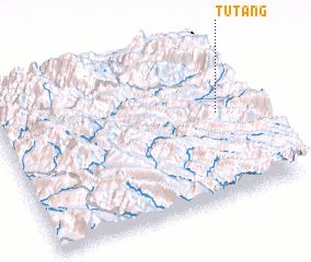 Places with similar names to Tūtang, Iran ::
Disclaimer :: Information on this page comes without warranty of any kind |
||
|
Where is Tūtang? Elevation and coordinates ::
Latitude (lat): 31°32'45"N Longitude (lon): 50°52'50"E
Elevation (approx.): 1653m (map arrows pan, magnifying glasses zoom) |
||
|
Visiting Tūtang? Hotel/Accommodation ::
Book a hotel in Tūtang Travel Guide ::
Buy a travel guide for Iran rental cars ::
car rental offers GPS waypoint ::
download a GPX waypoint (PoI) of Tūtang for your GPS receiver
|
||