|
search place name
|
||
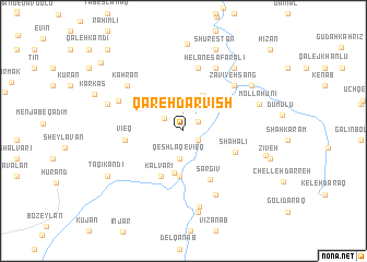
Qareh Darvīsh (Iran)Qareh Darvīsh is a town in Iran. An overview map of the region around Qareh Darvīsh is displayed below.
regional and 3d topo map of Qareh Darvīsh, Iran ::
Qareh Darvīsh airports ::
The nearest airport is TBZ - Tabriz Intl, located 139.0 km south west of Qareh Darvīsh.
Nearby towns ::
Qārqūlū (1.4km north east) //
Harasbān (1.5km south east) //
Havāy (2.0km north west) //
Qeshlāq-e Vīeq (2.8km south) //
Khāsh Qeshlāqī (3.9km north east) //
Leghlān (4.4km south) //
Gonbadān (4.7km south) //
Kalvarī (5.0km south) //
Sargīv (5.4km south east) //
Shāh ‘Ālī (4.7km south east) //
Vīeq (4.7km west) //
Qareh Tīkānlū (6.6km north) //
Zāvīyeh Sang (6.1km north east) //
Helān-e Şafar‘alī (6.9km north) //
Qotānlū (7.0km south) //
Yūsefābād (6.0km north west) //
Kahrān (6.5km north west) //
Tāzeh Kand (7.9km south) //
‘Emāratlū (7.6km north east) //
Mollā Ḩūnī (6.6km north east) //
Ja‘farābād (6.7km north west) //
Anjīrlū (7.1km north east) //
Tāzeh Kand-e Yāft (8.4km south) //
Shaghlān (7.0km east) //
Shūrestān (8.7km north) //
Taqī Kandī (7.7km south west) //
Noqadī (7.7km south west) //
Zīveh (7.5km east) //
Kavīr (9.6km north west) //
[all distances 'as the bird flies' and approximate]  Places with similar names to Qareh Darvīsh, Iran ::
// Qarah Darvīsh (IR)
Disclaimer :: Information on this page comes without warranty of any kind |
||
|
Where is Qareh Darvīsh? Elevation and coordinates ::
Latitude (lat): 38°54'31"N Longitude (lon): 47°29'13"E
Elevation (approx.): 687m (map arrows pan, magnifying glasses zoom) |
||
|
Visiting Qareh Darvīsh? Hotel/Accommodation ::
Book a hotel in Qareh Darvīsh Travel Guide ::
Buy a travel guide for Iran rental cars ::
car rental offers GPS waypoint ::
download a GPX waypoint (PoI) of Qareh Darvīsh for your GPS receiver
|
||