|
search place name
|
||
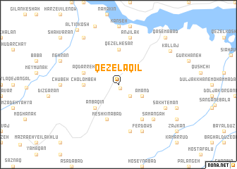
Qezel ‘Aqīl (Iran)Qezel ‘Aqīl is a town in Iran. An overview map of the region around Qezel ‘Aqīl is displayed below.
regional and 3d topo map of Qezel ‘Aqīl, Iran ::
Qezel ‘Aqīl airports ::
The nearest airport is RAS - Rasht, located 83.2 km north east of Qezel ‘Aqīl.
Other airports nearby include RZR - Ramsar (135.2 km east), Nearby towns ::
Sīrdān (0.6km south east) //
Zājkān (2.4km south east) //
‘Amand (3.5km south east) //
Anbaqīn (4.8km south west) //
Qezel Ḩeşār (5.6km north) //
Cholombeh (4.5km west) //
Meshkīnābād (5.8km south) //
Āq Darreh (4.8km north west) //
Naşīrābād (6.3km south east) //
Anjīlak (7.6km north) //
Ḩasanābād (7.6km south) //
Kūchīcheklū (7.1km south east) //
Samangāh (7.1km south east) //
Ferdows (8.0km south) //
Sākhtemān (7.0km south east) //
Chāy Ūbāshī (8.7km north west) //
Kallaj (8.5km north east) //
Qāsemābād (9.5km north east) //
Āltīn Kosh (10.1km north west) //
[all distances 'as the bird flies' and approximate] 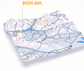 Places with similar names to Qezel ‘Aqīl, Iran ::
// Güzeloğlu (TR)
// Kazlıgöl (TR)
// Kazlıgöl (TR)
// Kışlaoğlu (TR)
// Kızılcaali (TR)
// Kızılcalı (TR)
// Kızılkale (TR)
// Kızılkule (TR)
// Gozolokolo (RU)
// Kyzyl-Kala (RU)
Disclaimer :: Information on this page comes without warranty of any kind |
||
|
Where is Qezel ‘Aqīl? Elevation and coordinates ::
Latitude (lat): 36°39'0"N Longitude (lon): 49°12'0"E
Elevation (approx.): 1126m (map arrows pan, magnifying glasses zoom) |
||
|
Visiting Qezel ‘Aqīl? Hotel/Accommodation ::
Book a hotel in Qezel ‘Aqīl Travel Guide ::
Buy a travel guide for Iran rental cars ::
car rental offers GPS waypoint ::
download a GPX waypoint (PoI) of Qezel ‘Aqīl for your GPS receiver
|
||