|
search place name
|
||
Rastak (Iran)Rastak is a town in Iran. An overview map of the region around Rastak is displayed below.
regional and 3d topo map of Rastak, Iran ::

Rastak airports ::
The nearest airport is THR - Teheran Mehrabad Intl, located 115.3 km north east of Rastak.
Nearby towns ::
‘Abdollāhābād (1.8km north west) //
‘Abdolābād-e Pā'īn (2.4km north west) //
Şafdar (3.0km north west) //
Raḩmatābād (3.2km west) //
Maḩmūdābād (3.5km west) //
Ḩoseynābād-e Zand (3.7km north west) //
Ma‘şūmābād (5.0km north) //
Ḩājjīābād (4.6km south west) //
Sharīfābād-e Zand (4.8km west) //
Ḩeydarābād (4.9km west) //
Shāhbostān (4.9km west) //
Ma‘şūmābād (5.8km north east) //
Sharīfābād (6.1km north) //
Sa‘dābād (6.8km north west) //
Karīmābād (6.4km west) //
Moḩammadābād-e Eslāmī (7.7km north) //
Dowlatābād (6.6km west) //
Pāchīān (6.7km west) //
Feyẕābād (8.1km north east) //
Ja‘farābād (7.3km west) //
Sīnak (8.7km north west) //
Khorramābād (8.4km north west) //
[all distances 'as the bird flies' and approximate] 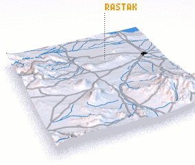 Places with similar names to Rastak, Iran ::
Disclaimer :: Information on this page comes without warranty of any kind |
||
|
Where is Rastak? Elevation and coordinates ::
Latitude (lat): 34°48'9"N Longitude (lon): 50°39'11"E
Elevation (approx.): 908m (map arrows pan, magnifying glasses zoom) |
||
|
Visiting Rastak? Hotel/Accommodation ::
Book a hotel in Rastak Travel Guide ::
Buy a travel guide for Iran rental cars ::
car rental offers GPS waypoint ::
download a GPX waypoint (PoI) of Rastak for your GPS receiver
|
||