|
search place name
|
||
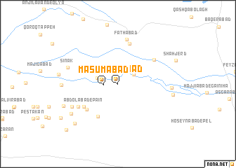
Ma‘şūmābād (Iran)Ma‘şūmābād is a town in Iran. An overview map of the region around Ma‘şūmābād is displayed below.
regional and 3d topo map of Ma‘şūmābād, Iran ::
Ma‘şūmābād airports ::
The nearest airport is THR - Teheran Mehrabad Intl, located 109.5 km north east of Ma‘şūmābād.
Nearby towns ::
Moḩammadābād-e Eslāmī (2.0km north) //
Ma‘şūmābād (1.9km west) //
Feyẕābād (2.6km north east) //
Sharīfābād (2.9km west) //
Rastak (5.8km south west) //
‘Abdollāhābād (5.7km south west) //
‘Abdolābād-e Pā'īn (5.7km south west) //
Aḩmadābād-e Shādjerd (6.6km north) //
Maḩmūdābād (6.1km north east) //
Fatḩābād (7.2km north) //
Şafdar (6.3km south west) //
Ḩoseynābād-e Zand (7.0km south west) //
Sīnak (7.0km west) //
Shamsābād (7.0km east) //
Maḩmūdābād (7.8km south west) //
Reẕāābād-e Gā'īnī (7.4km east) //
Raḩmatābād (8.4km south west) //
Sharīfābād-e Zand (7.9km south west) //
Ḩājjīābād (10.0km south west) //
[all distances 'as the bird flies' and approximate]  Places with similar names to Ma‘şūmābād, Iran ::
// Māsimābād (BD)
// Mozamābād (IN)
// Meys̄amābād (IR)
// Mowsemābād (IR)
// Moazzamābād (PK)
// Muazzamābād (PK)
// Ma‘şūmābād (IR)
// Ma‘şūmābād (IR)
// Ma‘şūmābād (IR)
// Ma‘şūmābād (IR)
Disclaimer :: Information on this page comes without warranty of any kind |
||
|
Where is Ma‘şūmābād? Elevation and coordinates ::
Latitude (lat): 34°50'56"N Longitude (lon): 50°40'55"E
Elevation (approx.): 898m (map arrows pan, magnifying glasses zoom) |
||
|
Visiting Ma‘şūmābād? Hotel/Accommodation ::
Book a hotel in Ma‘şūmābād Travel Guide ::
Buy a travel guide for Iran rental cars ::
car rental offers GPS waypoint ::
download a GPX waypoint (PoI) of Ma‘şūmābād for your GPS receiver
|
||