|
search place name
|
||
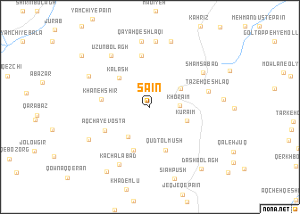
Sā'īn (Ardabīl, Iran)Sā'īn is a town in the Ardabīl region of Iran. An overview map of the region around Sā'īn is displayed below.
regional and 3d topo map of Sā'īn, Iran ::
Sā'īn airports ::
The nearest airport is RAS - Rasht, located 143.1 km south east of Sā'īn.
Other airports nearby include TBZ - Tabriz Intl (173.0 km west), Nearby towns ::
Khorā'īm (3.0km east) //
Ḩājjī Maḩmūd (3.8km north east) //
Āqchāy-e Soflá (4.3km south west) //
Kūrā'īm (4.0km south east) //
Kalāsh (4.7km north west) //
Qūd Tolmūsh (5.6km south) //
Pāreh Chīn (5.6km south) //
Khāneh Shīr (4.9km west) //
Āqchāy-e Vosţá (5.3km south west) //
Amīnābād (6.5km north) //
Tāzeh Qeshlāq (6.0km east) //
Shamsābād (6.8km north east) //
Ūzūn Bolāgh (7.4km north west) //
Kachalābād (7.8km south west) //
Kalash-e Kūchek (8.3km north) //
Qayah Qeshlāqī (8.3km north) //
Dāsh Bolāgh (7.1km north west) //
Īncheh (8.5km north) //
Āqchāy-e ‘Olyā (7.3km south west) //
Tūtūnsīz (9.1km south west) //
Dāshbolāgh (9.3km south east) //
Amīnābād (9.3km north west) //
[all distances 'as the bird flies' and approximate] 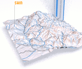 Places with similar names to Sā'īn, Iran ::
Disclaimer :: Information on this page comes without warranty of any kind |
||
|
Where is Sā'īn? Elevation and coordinates ::
Latitude (lat): 37°57'33"N Longitude (lon): 48°11'36"E
Elevation (approx.): 1568m (map arrows pan, magnifying glasses zoom) |
||
|
Visiting Sā'īn? Hotel/Accommodation ::
Book a hotel in Sā'īn Travel Guide ::
Buy a travel guide for Iran rental cars ::
car rental offers GPS waypoint ::
download a GPX waypoint (PoI) of Sā'īn for your GPS receiver
|
||