|
search place name
|
||
Sar Shūr (Sīstān va Balūchestān, Iran)Sar Shūr is a town in the Sīstān va Balūchestān region of Iran. An overview map of the region around Sar Shūr is displayed below.
regional and 3d topo map of Sar Shūr, Iran ::

Sar Shūr airports ::
The nearest airport is TRB - Turbo Turbat Intl, located 134.0 km south east of Sar Shūr.
Other airports nearby include GWD - Gwadar (165.6 km south), ZBR - Chah Bahar (207.4 km south west), PSI - Pasni (209.3 km south east), Nearby towns ::
Sohāndarān (0.2km south) //
Īrafshān (0.4km north west) //
Sarshūr-e Pā'īn (1.6km north west) //
Dārān (1.9km north west) //
Damrūd (2.0km north east) //
Kahnāb (2.1km north west) //
Sar Qal‘eh (3.2km north west) //
[all distances 'as the bird flies' and approximate] 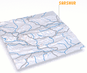 Places with similar names to Sar Shūr, Iran ::
// Cerchiara (IT)
// Cerchiara (IT)
// Sérètiouri (BJ)
// Sirröshirra (CO)
// Sar Shūr (IR)
// Sar Shūreh (IR)
// Z̧ahr Shīr (IR)
// Surshahr (PK)
// Zāra Churrai (PK)
// Zar Shahr (PK)
Disclaimer :: Information on this page comes without warranty of any kind |
||
|
Where is Sar Shūr? Elevation and coordinates ::
Latitude (lat): 26°41'5"N Longitude (lon): 61°56'2"E
Elevation (approx.): 904m (map arrows pan, magnifying glasses zoom) |
||
|
Visiting Sar Shūr? Hotel/Accommodation ::
Book a hotel in Sar Shūr Travel Guide ::
Buy a travel guide for Iran rental cars ::
car rental offers GPS waypoint ::
download a GPX waypoint (PoI) of Sar Shūr for your GPS receiver
|
||