|
search place name
|
||
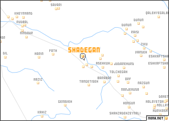
Shādegān (Ostān-e Kohgīlūyeh va Būyer Aḩmad, Iran)Shādegān is a town in the Ostān-e Kohgīlūyeh va Būyer Aḩmad region of Iran. An overview map of the region around Shādegān is displayed below.
regional and 3d topo map of Shādegān, Iran ::
Shādegān airports ::
The nearest airport is MRX - Bandar Mahshahr Mahshahr, located 169.5 km west of Shādegān.
Other airports nearby include BUZ - Bushehr (179.6 km south), SYZ - Shiraz Shahid Dastghaib Intl (197.1 km south east), QMJ - Masjed Soleiman Shahid Asyaee (223.8 km north west), Nearby towns ::
Keh Sarak-e ‘Olyā (1.1km south east) //
Keh Sarak-e Soflá (1.5km south) //
Cheshmeh Reshteh (2.1km south east) //
Shāh Bahrām (2.2km north east) //
Derk (3.1km east) //
Lār (3.7km east) //
Āseh Kūh (3.9km south east) //
Tang-e Tīseh (5.6km south) //
Ābgarm Kūh (5.3km east) //
Barābar (6.2km south east) //
Fatḩ (6.1km west) //
Tolchegāh (7.4km south east) //
Anjīreh (8.0km south east) //
Jūdar-e Mūrd (7.8km east) //
Chezangūn (10.7km south east) //
[all distances 'as the bird flies' and approximate] 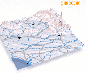 Places with similar names to Shādegān, Iran ::
// Chodków Nowy (PL)
// Shtiqën (AL)
// Chiţcani (RO)
// Chiţcani (RO)
// Chitkan (RU)
// Shaytakān (IQ)
// Chādgān (IR)
// Chah Dogāneh (IR)
// Chauddakāni (BD)
// Chitocán (GT)
Disclaimer :: Information on this page comes without warranty of any kind |
||
|
Where is Shādegān? Elevation and coordinates ::
Latitude (lat): 30°33'48"N Longitude (lon): 50°55'6"E
Elevation (approx.): 1018m (map arrows pan, magnifying glasses zoom) |
||
|
Visiting Shādegān? Hotel/Accommodation ::
Book a hotel in Shādegān Travel Guide ::
Buy a travel guide for Iran rental cars ::
car rental offers GPS waypoint ::
download a GPX waypoint (PoI) of Shādegān for your GPS receiver
|
||