|
search place name
|
||
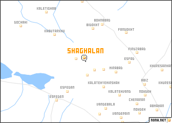
Shaghālān (Iran)Shaghālān is a town in Iran. An overview map of the region around Shaghālān is displayed below.
regional and 3d topo map of Shaghālān, Iran ::
Shaghālān airports ::
The nearest airport is XBJ - Birjand, located 106.6 km south west of Shaghālān.
Nearby towns ::
Mazra‘eh-ye Movaqat-e ‘Abbāsī (1.9km west) //
Kalāteh-ye Mīrzā Yūsof (2.4km south east) //
Zīārat (2.4km north east) //
Kalāteh-ye Pīshkūh (3.0km south) //
Mīlā Kūh (3.7km south east) //
Kalāteh-ye Mīr Shāh (6.4km south east) //
Mīrābād (6.0km south east) //
Bīdokht (7.2km north) //
Esfedān (7.4km south west) //
Bohnābād (8.6km north) //
Kabūtar Khū (8.1km north west) //
Kalāteh Vand (9.6km south east) //
Esfeden (10.0km south west) //
Fandokht (9.6km north east) //
[all distances 'as the bird flies' and approximate] 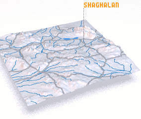 Places with similar names to Shaghālān, Iran ::
Disclaimer :: Information on this page comes without warranty of any kind |
||
|
Where is Shaghālān? Elevation and coordinates ::
Latitude (lat): 33°44'0"N Longitude (lon): 59°50'0"E
Elevation (approx.): 2224m (map arrows pan, magnifying glasses zoom) |
||
|
Visiting Shaghālān? Hotel/Accommodation ::
Book a hotel in Shaghālān Travel Guide ::
Buy a travel guide for Iran rental cars ::
car rental offers GPS waypoint ::
download a GPX waypoint (PoI) of Shaghālān for your GPS receiver
|
||