|
search place name
|
||
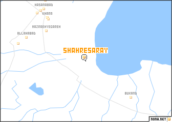
Shahr-e Sarāy (Eşfahān, Iran)Shahr-e Sarāy is a town in the Eşfahān region of Iran. An overview map of the region around Shahr-e Sarāy is displayed below.
regional and 3d topo map of Shahr-e Sarāy, Iran ::
Shahr-e Sarāy airports ::
The nearest airport is AZD - Yazd Shahid Sadooghi, located 148.6 km east of Shahr-e Sarāy.
Nearby towns ::
Mazra‘eh-ye Gāreh (9.9km north west) //
[all distances 'as the bird flies' and approximate]  Places with similar names to Shahr-e Sarāy, Iran ::
// Charozero (RU)
// Cherāgh Ḩeşārī (IR)
// Chārsar (IN)
// Shahrāsar (IR)
// Shahr-e Zūr (IR)
// Shūrehzār (IR)
// Cherisar (PK)
// Charcier (FR)
// Charézier (FR)
// Shara-Sur (RU)
Disclaimer :: Information on this page comes without warranty of any kind |
||
|
Where is Shahr-e Sarāy? Elevation and coordinates ::
Latitude (lat): 32°2'18"N Longitude (lon): 52°42'45"E
Elevation (approx.): 1456m (map arrows pan, magnifying glasses zoom) |
||
|
Visiting Shahr-e Sarāy? Hotel/Accommodation ::
Book a hotel in Shahr-e Sarāy Travel Guide ::
Buy a travel guide for Iran rental cars ::
car rental offers GPS waypoint ::
download a GPX waypoint (PoI) of Shahr-e Sarāy for your GPS receiver
|
||