|
search place name
|
||
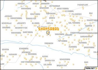
Shamsābād (Khorāsān, Iran)Shamsābād is a town in the Khorāsān region of Iran. An overview map of the region around Shamsābād is displayed below.
regional and 3d topo map of Shamsābād, Iran ::
Shamsābād airports ::
The nearest airport is ASB - Ashkhabad Ashgabat, located 210.7 km north of Shamsābād.
Nearby towns ::
Mīrābād (0.4km east) //
Sharīfābād (0.6km west) //
Banīābād (1.8km north) //
Āhangarān (2.0km west) //
Ḩanţābād (2.5km north west) //
Hāshemābād (2.7km north west) //
Jālandeh (2.6km north east) //
Bolqosheh (3.3km north) //
Eslāmīyeh (3.0km north west) //
Dehnow-e Sarbor (3.0km north west) //
Kārjīj (3.6km north) //
Malekandeh (2.9km west) //
Ḩanţābād (3.1km north west) //
Naqdbīsh (4.1km south) //
Şadrābād (3.4km east) //
Karīmābād-e Moţlaq (3.8km north east) //
Moḩammadābād (4.1km north east) //
Amīnābād (4.2km north east) //
Qāsemābād (3.7km west) //
Sabūs (3.8km east) //
Zarjān (3.9km south east) //
Ferdows (3.8km east) //
Now Kārīz (4.0km west) //
Deh-e Dārūgheh (4.1km west) //
Nowkārīz (4.1km west) //
Farhād (4.1km west) //
Masīḩābād (4.7km north west) //
Moḩīţābād (4.5km north west) //
Shād Mehrak (5.4km north) //
[all distances 'as the bird flies' and approximate] 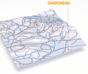 Places with similar names to Shamsābād, Iran ::
Disclaimer :: Information on this page comes without warranty of any kind |
||
|
Where is Shamsābād? Elevation and coordinates ::
Latitude (lat): 36°7'3"N Longitude (lon): 58°46'42"E
Elevation (approx.): 1130m (map arrows pan, magnifying glasses zoom) |
||
|
Visiting Shamsābād? Hotel/Accommodation ::
Book a hotel in Shamsābād Travel Guide ::
Buy a travel guide for Iran rental cars ::
car rental offers GPS waypoint ::
download a GPX waypoint (PoI) of Shamsābād for your GPS receiver
|
||